
Explore 20 Years of Rain and Snowfall Data from NASA’s Precipitation Missions
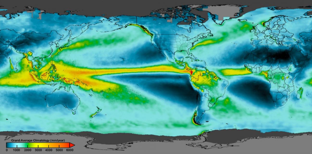
A new data product merges data from the Tropical Rainfall Measuring Mission (TRMM) and the Global Precipitation Measurement (GPM) mission, giving meteorologists and researchers access to a 20-year precipitation record.
How much rain and snow fall on Earth in any given year? NASA scientists are answering this question more accurately than ever before and observing precipitation in the most remote places on Earth. And it’s all thanks to an international constellation of satellites.
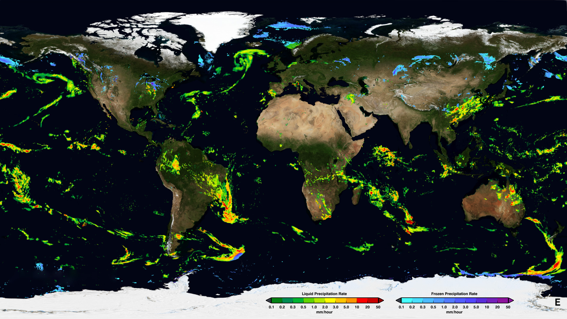
An example of the GPM IMERG Early Run half-hourly precipitation rates from January 24th, 2020. Learn more about IMERG
At any given time, instruments onboard about a dozen satellites contribute to a record of the world’s rain and snow. Together, these instruments make up the joint NASA/Japan Aerospace Exploration Agency (JAXA) Global Precipitation Measurement (GPM) mission. "Most of the satellites contributing to GPM aren’t precipitation satellites, per se," said George Huffman, who is deputy project scientist for GPM. A lot of the satellites providing passive microwave measurements of precipitation to the mission are tasked with different missions. For example, the instruments onboard the joint NASA/NOAA Suomi National Polar-orbiting Partnership (Suomi NPP) satellite contribute to our understanding of the ever-changing three-dimensional structure of atmospheric temperature and humidity, land cover and vegetation, and nighttime lights. Suomi NPP also provides passive microwave measurements to GPM. The combined measurements from these satellites allow GPM to provide a picture of precipitation around the world every 30 minutes.
The current constellation is anchored by the GPM Core Observatory, which was launched in 2014 by NASA and JAXA. The Core Observatory satellite has an advanced active radar instrument called the Dual-frequency Precipitation Radar (DPR) that measures both liquid and frozen water. It also has the GPM Microwave Imager (GMI) instrument, a multi-channel microwave radiometer which serves an essential role in the near-global-coverage and frequent-revisit-time requirements of GPM. Precipitation estimates from the Core Observatory satellite are used to calibrate the data from the other satellites. Data from GPM satellites are also instrumental in hurricane forecasting.
IMERG
Last year, GPM upgraded its data algorithms to calibrate and incorporate the Tropical Rainfall Measuring Mission (TRMM) data into its data record. TRMM was a research satellite in operation from 1997 to 2015. The NASA algorithm—the Integrated Multi-satellitE Retrievals for GPM (IMERG)—fuses data from the TRMM and GPM missions, giving meteorologists and researchers access to a 20-year precipitation record (from June 1, 2000 to present).
Before TRMM and GPM, researchers had to depend on less-accurate satellite infrared data for determining how much precipitation fell over the ocean or in remote areas without on-the-ground precipitation-measuring instruments. IMERG incorporates monthly surface precipitation gauge data in the "Final" data product (used for research) to correct for bias in the satellite estimates, where gauge data are available. This on-the-ground data is critical for validating measurements from satellites. Snow-covered surfaces can interfere with satellite measurements of snowfall, but on-the-ground measurements are helping GPM scientists fine-tune the IMERG algorithm.
The longer the data record, the more valuable it is to researchers and meteorologists. "We probably know more about precipitation in 1998 now than we did in 1998," said Huffman. Huffman and colleagues are working to add TRMM data back to 1998 to this record using the IMERG algorithm.
Read the full article at https://earthdata.nasa.gov/learn/articles/20-years-of-precipitation-data