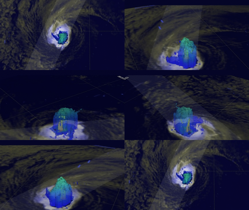
3D Precipitation Structure Within Hurricane Orlene Examined By GPM Satellite

Orlene, the 9th hurricane of the 2016 eastern Pacific season has weakened to a tropical storm. The GPM core observatory satellite flew over on September 15, 2016 at 1801 UTC when Orlene was still a hurricane with winds reaching about 70 kts (81 mph). Hurricane Orlene's rainfall was examined in 3-D using data collected by the GPM satellite's Dual-Frequency Precipitation Radar (DPR). This digital "CAT scan" like view inside hurricane Orlene shows the locations of the most intense rainfall. An area of heavy downpours was uncovered near the center of Orlene's center of circulation. Radar reflectivity values greater than 40dBZ are shown (yellow) near the hurricane's center. This DPR examination also shows that the tallest storms within hurricane Orlene reached about 10.3 km (6.4 miles).

