
Arlene Becomes Rare Atlantic Tropical Cyclone
Tropical storms are quite rare in the Atlantic at this time of the year, which
is why the formation of Tropical Storm Arlene in the north Central Atlantic
yesterday, Thursday April 20th at 5:00 pm EDT, was so unusual. The National
Hurricane Center (NHC) noted that Arlene became only the 2nd tropical storm to form in the Atlantic during the month of April in the entire satellite era, the other being Tropical Storm Ana back in 2003.
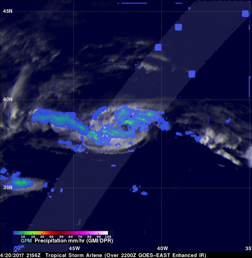
GPM captured this timely image of Arlene just after the NHC officially designated it to be a tropical storm. The image was taken at 21:56 UTC (5:56 pm EDT) on Thursday April 20th. GPM shows that Arlene is a rather small storm, but GPM's DPR cleary shows an eye-like feature at the center surrounded by bands of weak (shown on blue) to moderate (shown in green) rain. These rainbands also show evidence of curvature and reflect the presence of Arlene's cyclonic circulation. At the time of this image, NHC estimated Arlene's maximum sustained winds to be at 40 knots (~45 mph).
Arlene originated from an old frontal boundary that had stalled out in the central Atlantic. The front, however, provided the focus for some showers and thunderstorms, which eventually allowed Arlene to form first as a sub-tropical storm then later to become a tropical storm. As of Friday, Arlene has become absorbed into a much larger nearby extra-tropical cyclone, and convection within Arlene has died down, leading NHC to downgrade the system to a post-tropical cyclone, which is expected to further decay and dissipate well away from land.