
Danielle Hits Mexico And Weakens
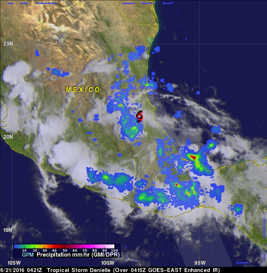
Tropical Storm Danielle started weakening after making landfall north of Tuxpan, Mexico on Monday evening just before June 21, 2016 at 0000 UTC (June 20, 2016 7:00 PM CDT). As Danielle weakened the low level circulation quickly became disorganized.
The GPM core observatory satellite passed above rapidly weakening Danielle on June 21, 2016 at 0421Z (June 20, 2016 11:21 PM CDT). The approximate center of Danielle's circulation at the time of this GPM pass is shown with a red tropical storm symbol. A rainfall analysis from GPM's Microwave Imager (GMI) and Dual-Frequency Precipitation Radar (DPR) shows that there were only a few areas where rainfall was still falling at moderate to heavy rates. This analysis shows rain falling at a rate of close to 41 mm (1.6 inches) per hour northwest of the approximate center of the tropical depression. The heaviest precipitation of almost 157 mm (6.2 inches) per hour was measured by DPR off the Mexican coast east of Veracruz.
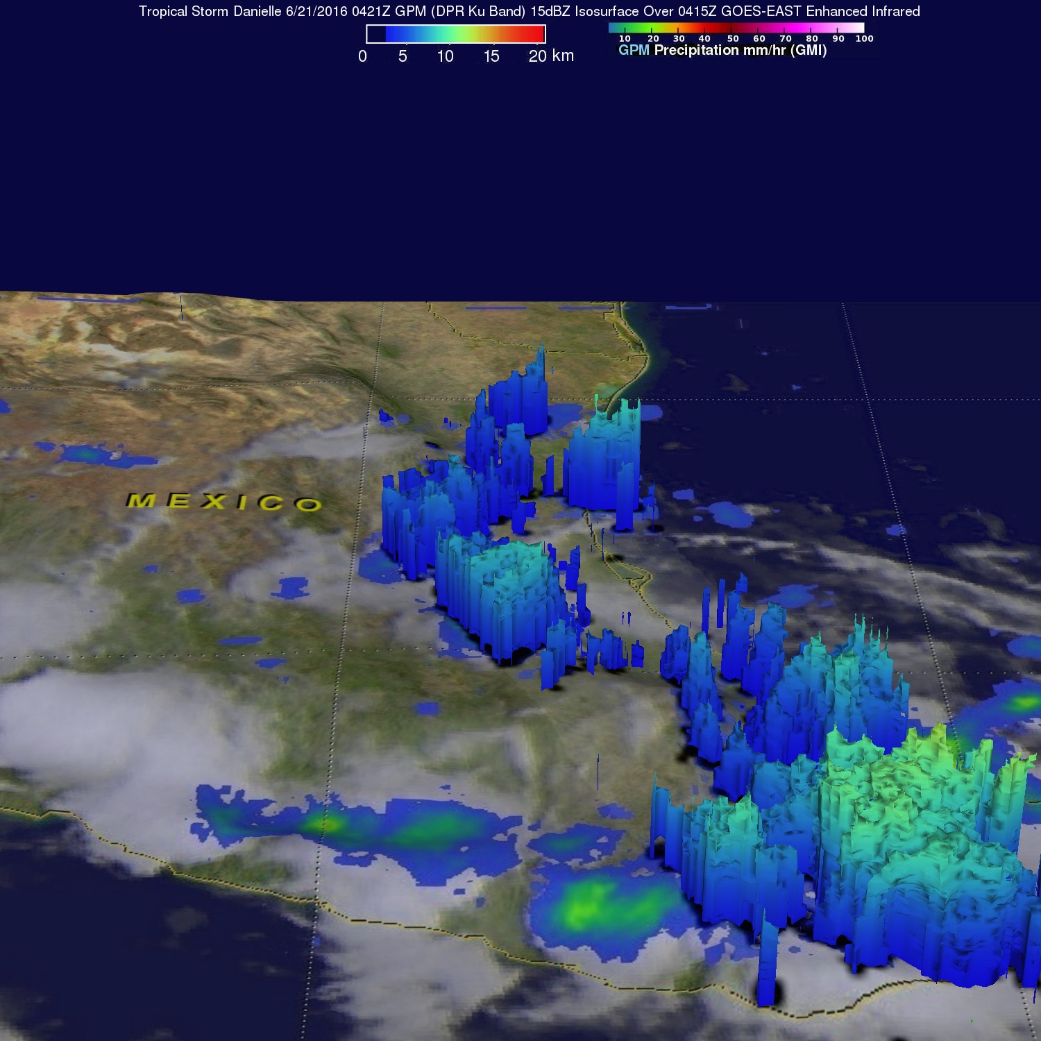
GPM's Radar (DPR Ku Band) were used to view the 3-D structure of precipitation within the weakening storm. Storm top heights were shown by DPR to reach maximum heights of about 14.3 km (8.9 miles) in a few storms northwest of the storm's disorganized circulation. A few of the stormy remnants of Danielle are predicted by the National Hurricane Center (NHC) to present a flash flood risk for south-central and southwestern Mexico today.