Deadly Tropical Cyclone Enawo Drenches Madagascar
Tropical cyclone Enawo hit Madagascar on Tuesday with powerful winds and drenching rain. At least three people have been reported killed by the tropical cyclone. Floods and landslides are likely as Enawo moves southward down the center of Madagascar. Tropical cyclones rotate in a clockwise direction in the southern hemisphere so the eastern side of Madagascar will have a strong onshore flow. The extreme amount of moisture flowing onto Madagascar from the Indian Ocean is expected to produce flooding and landslides.
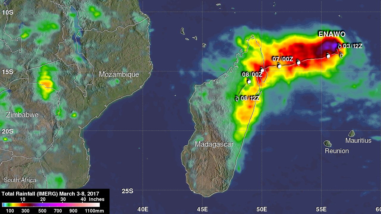
NASA's Integrated Multi-satelliE Retrievals for GPM (IMERG) data are produced using data from the satellites in the GPM Constellation, and is calibrated with measurements from the GPM Core Observatory as well as rain gauge networks around the world. The preliminary IMERG rainfall analysis shown here was derived from IMERG data collected from March 3-8, 2017. Tropical cyclone Enawo formed northeast of Madagascar on March 3, 2017. The tropical cyclone dropped the highest rainfall totals of over 500 mm ( almost 20 inches) in the open waters of the Indian Ocean northeast of Madagascar. The approximate path and intensity of tropical cyclone Enawo is shown overlaid in white.
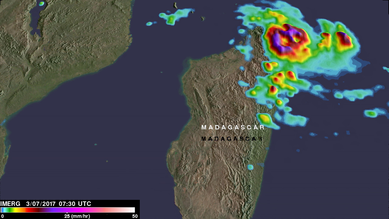
IMERG real-time data are generated by NASA's Precipitation Processing System every half hour and are normally available within six hours. This image shows IMERG rainfall data for March 7, 2017 at 0730 UTC when tropical cyclone Enawo was dropping extremely heavy precipitation over north-eastern Madagascar as it moved in from the Indian Ocean.