
Deadly Tropical Storm Kai-tak Examined With IMERG And GPM Satellite
Tropical storm KAI-TAK was nearly stationary at times as it drenched the Philippines during the past five days. The storm caused major flooding and landslides. Many homes, roads and bridges were reported destroyed by landslides. Over 30 deaths were caused by the slow-moving tropical storm.
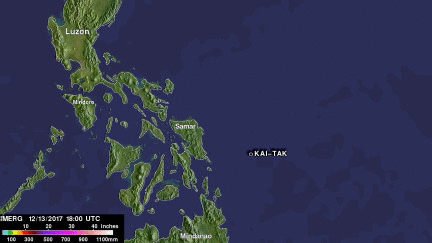
A rainfall accumulation analysis of tropical cyclone KAI-TAK was derived from NASA's Integrated Multi-satellitE Retrievals data (IMERG) for the period from December 13-18, 2017. Tropical cylone KAI-TAK's approximate locations and positions are shown overlaid in white on this analysis. IMERG data were used to calculate estimates of precipitation from a combination of space-borne passive microwave sensors, including the GMI microwave sensor onboard the GPM satellite, and geostationary IR (infrared) data. An animation of IMERG rainfall accumulation total estimates shows the locations of the tropical cyclone KAI-TAK's heavy rainfall as it drenched the central Philippines. These IMERG rainfall estimates showed that very heavy rainfall occurred along the tropical storm's track from the Philippine Sea through the central Philippines. IMERG rainfall totals of over 512 mm (20.2 inches) were shown by IMERG near the tropical storm's track.
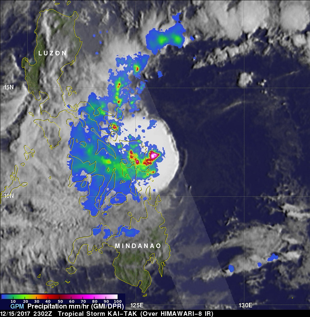
The GPM core observatory satellite flew over tropical storm KAI-TAK as it was crossing into the eastern Philippines on December 15, 2017 at 2302 UTC. GPM's Microwave Imager (GMI) and Dual-Frequency Precipitation Radar (DPR) instruments received data that showed the locations of very heavy rainfall inside the tropical storm. GPM's radar (DPR Ku Band)observed that the maximum rainfall rate at that time was greater than 193 mm (7.59 inches) per hour in storms located just east of the central Philippines.
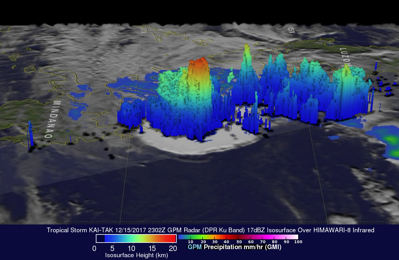
GPM's radar (DPR Ku band) data revealed the 3-D shape of precipitation in powerful thunderstorms within KAI-TAK. DPR showed that some storm top heights over the Philippine Sea were reaching altitudes above 17.9 km (11.1 miles).
Tropical depression KAI-TAK has weakened while moving into the South China Sea southwest of the Philippines. Winds within the remnants of the tropical storm are predicted to drop to about 20 kts (23 mph) tomorrow.