
Forming Tropical Cyclone Examined By GPM
A tropical cyclone (TC05b) formed on December 7, 2016 in the eastern Bay Of Bengal. The Joint Typhoon Warning Center (JTWC) issued it's first advisory when TC05B was located just west of the Andaman and Nicobar Islands with winds of 35kts (~40 mph).
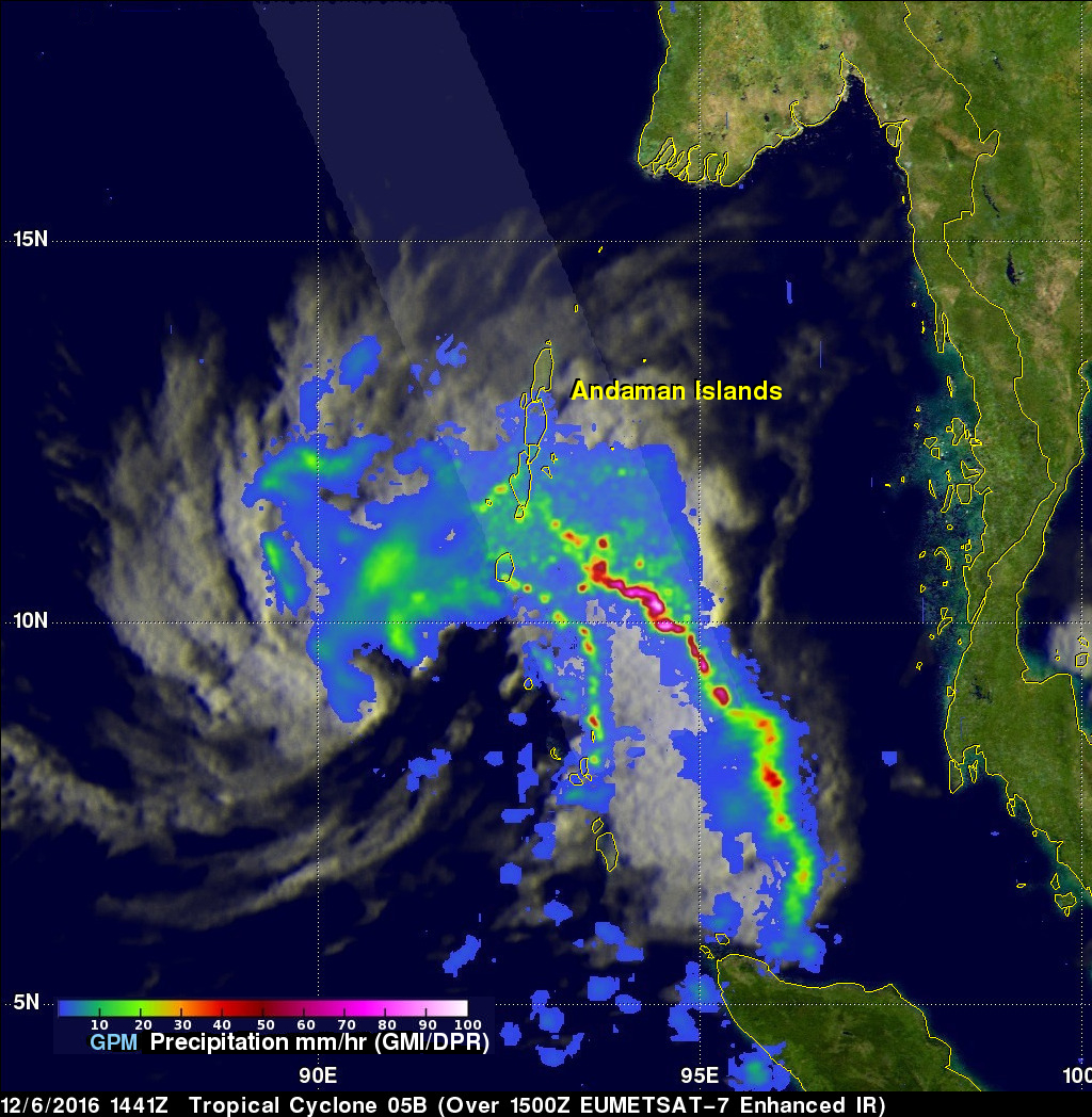
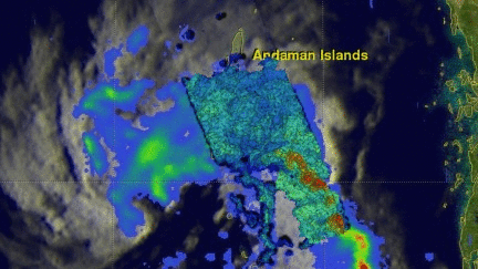
On December 6, 2016 at 1441 UTC the GPM core observatory satellite passed over the forming tropical cyclone. This image shows a rainfall analysis that was derived from GPM's Microwave Imager (GMI) and Dual-Frequency Precipitation Radar (DPR) data. GPM's radar (DPR Ku band) showed that the forming tropical cyclone had two bands of convective storms spiraling in from the southeast. One of the feeder bands contained some exceptionally strong convective thunderstorms. Some of these storms were dropping rain at a rate of well over 209 mm (8.2 inches) per hour.
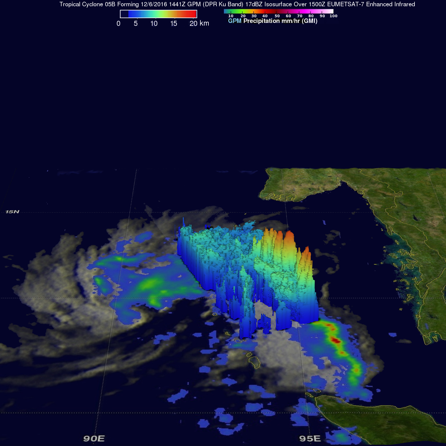
A 3-D view that was constructed from GPM's radar (DPR Ku band) shows that some of the powerful convective storms in the forming tropical cyclone reached great heights. DPR measured storm top heights in several of these storms that reached altitudes above 17 km (10.5 miles). Some extremely heavy downpours in these powerful storms were returning radar reflectivity values greater than 88 dBZ to the satellite.
The Joint Typhoon Warning Center (JTWC) predicts that TC05B will intensify as it turns toward the northwest into the center of the Bay Of Bengal. TC05B is expected to have winds of 65 kts (~75 mph) in a few days. The tropical cyclone is predicted to make landfall northeast of Chennai, India in about five days. By that time winds in the tropical cyclone are predicted to have weakened to about 40 kts (46 mph).