Forming Tropical Cyclone Near Madagascar Inspected By GPM
A new tropical cyclone may affect Madagascar in a few days. The Joint Typhoon Warning Center (JTWC) has been keeping an eye on an area of convection in the Indian Ocean northeast of Madagascar. A circulation center has already been observed. Environmental conditions are favorable for the birth of a tropical cyclone in that area with the presence of low vertical wind shear and warm sea surface temperatures. Tropical cyclone AVA caused many deaths in January when it's heavy rains caused extensive flooding in Madagascar. Tropical cyclone DUMAZILE also caused extensive flooding less than two weeks ago when it passed close to the eastern side of Madagascar.
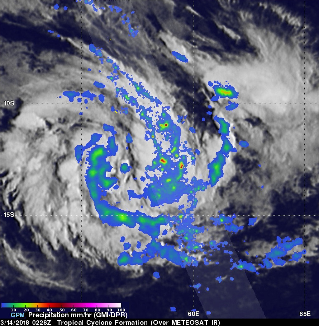
NASA's GPM core observatory satellite viewed the latest forming tropical cyclone when it flew over the Indian Ocean northeast of Madagascar on March 14, 2018 at 0228 UTC. The typical clockwise spiral of rain bands in the forming tropical cyclone were revealed with data collected by GPM's Microwave Imager (GMI) and Dual Frequency Precipitation Radar (DPR) instruments. GPM's radar probes of the large convective band wrapping around the eastern side of the forming tropical cyclone indicated that rain was dropping at a rate of over 207 (8.1 inches) per hour.
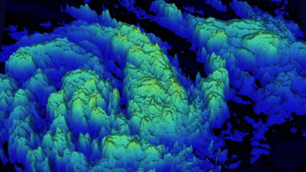
This 3-D flyby animation shows estimated cloud top heights that were calculated by blending data collected by GPM's radar (DPR Ku Band) with cloud top heights based on temperatures from the METEOSAT satellite's infrared image. Low cloud top heights are shown in blue while the tallest storm tops are displayed in dark yellow. GPM's DPR discovered that cloud tops were reaching higher than 16 km (9.9 miles) in the strong convective rain bands that are shown east of the forming tropical cyclone's center of circulation.