
Forming Tropical Storm Darby Analyzed By GPM
Tropical storm Darby became the fourth eastern Pacific Ocean tropical storm to form on July 12, 2016. Last year was an El Nino year and this year is transitioning to a La Nina year with cooler sea surface temperatures (SST) expanding across the eastern equatorial Pacific Ocean. Fewer tropical storms are normally expected to develop in the eastern Pacific Ocean during La Nina years but so far this year tropical cyclones are forming in the eastern Pacific Ocean at about the same pace as last year.
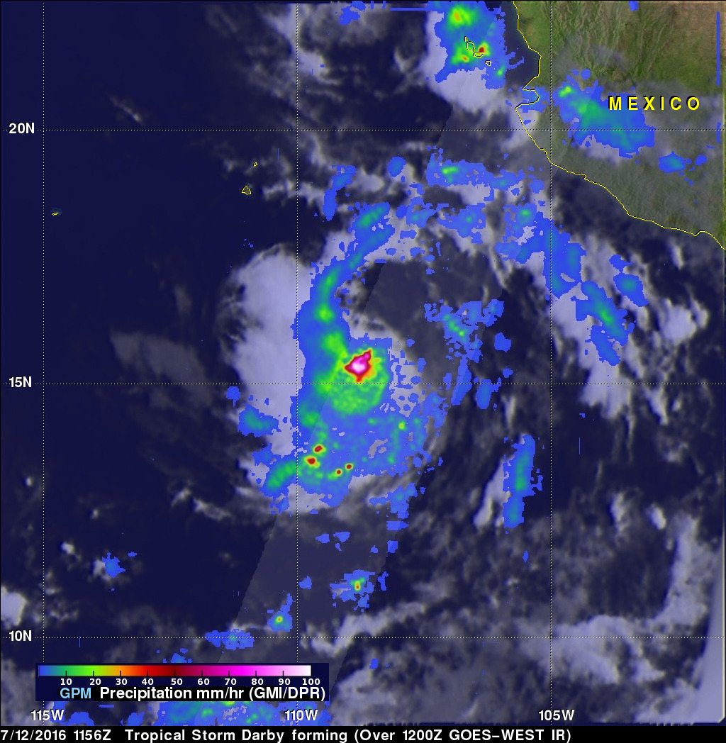
The GPM core observatory satellite flew above tropical depression five (TD05E) on July 12, 2016 at 1156 UTC when maximum sustained winds were estimated to be about 30 kts (34.5 mph). TD05E intensified and became tropical storm Darby later in the day. Data collected with this pass by GPM's Microwave Imager (GMI) and Dual-Frequency Precipitation Radar (DPR) instruments were used to estimate rainfall rates in TD05E. DPR data indicated that rain was falling at the extreme rate of over 163 mm (6.4 inches) per hour in powerful storms near TD05E's center of circulation.
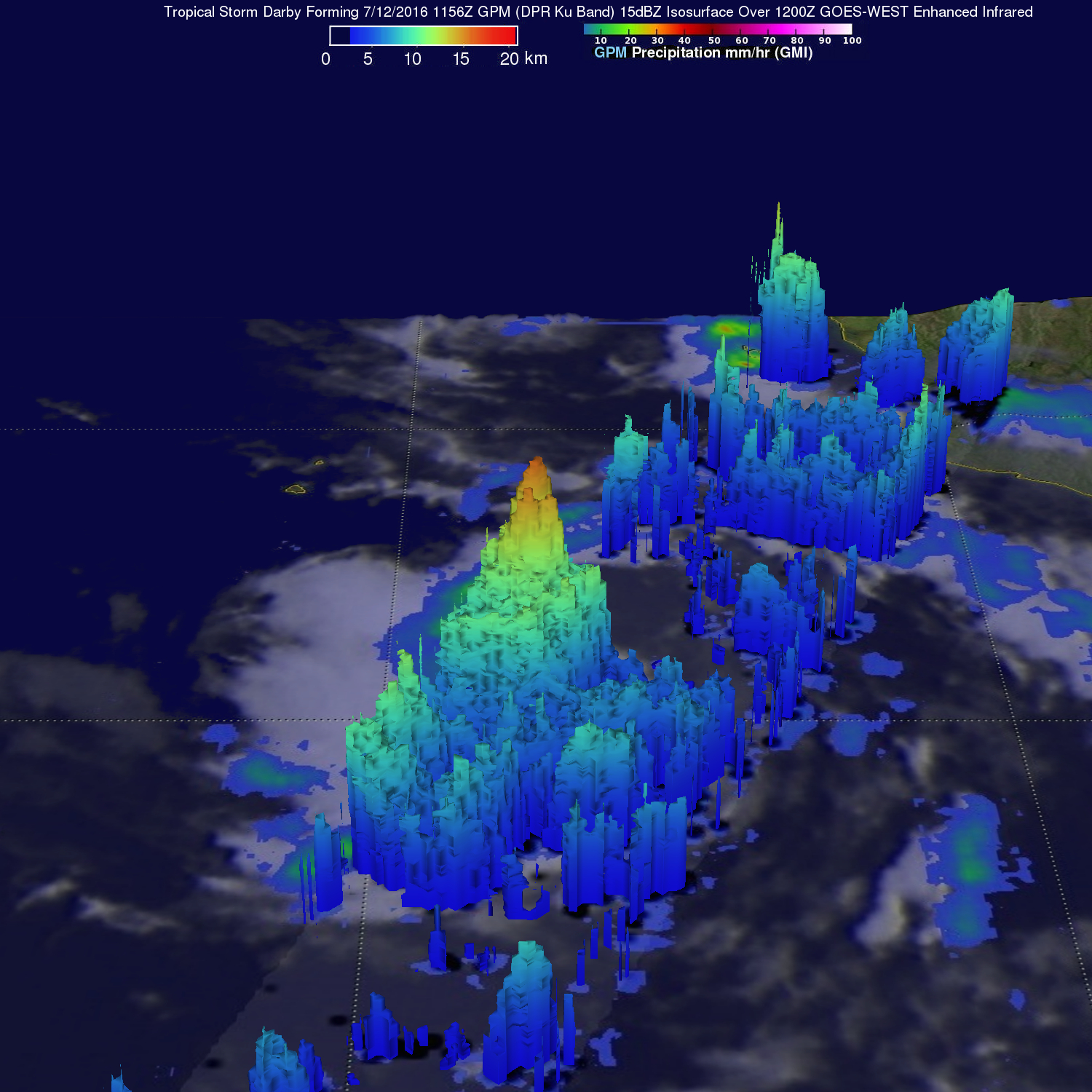
GPM's Radar (DPR Ku Band) data were used to measure the height of powerful storms in the tropical depression that contained intense rain showers. This 3-D view of TDO5E's rainfall structure showed that the tallest of the thunderstorms had storm top heights reaching above 16 km (9.9 miles).
Intensifying tropical storm Darby is predicted to become a hurricane today.