Gaston Hovers Around Hurricane Intensity as it Moves into the Central Atlantic
Gaston became the 3rd hurricane of the season early this morning (just after midnight EDT) as the storm was moving northwestward into the Central Atlantic about midway between the Leeward Islands and the Cape Verde Islands before weakening back into a tropical storm less than 12 hours later. Gaston is continuing to battle relatively strong environmental wind shear brought about by an upper-level low pressure center positioned to the west of Gaston. Winds flowing counter-clockwise around the upper low are blowing from the southwest while Gaston is moving northwest. These opposing winds are causing Gaston to become tilted and make it difficult for the storm to consolidate the energy being released through condensation in embedded thunderstorm updrafts.
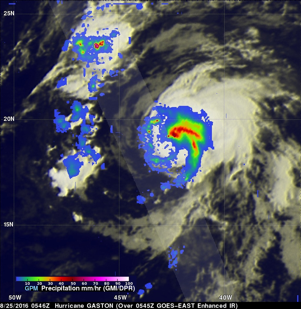
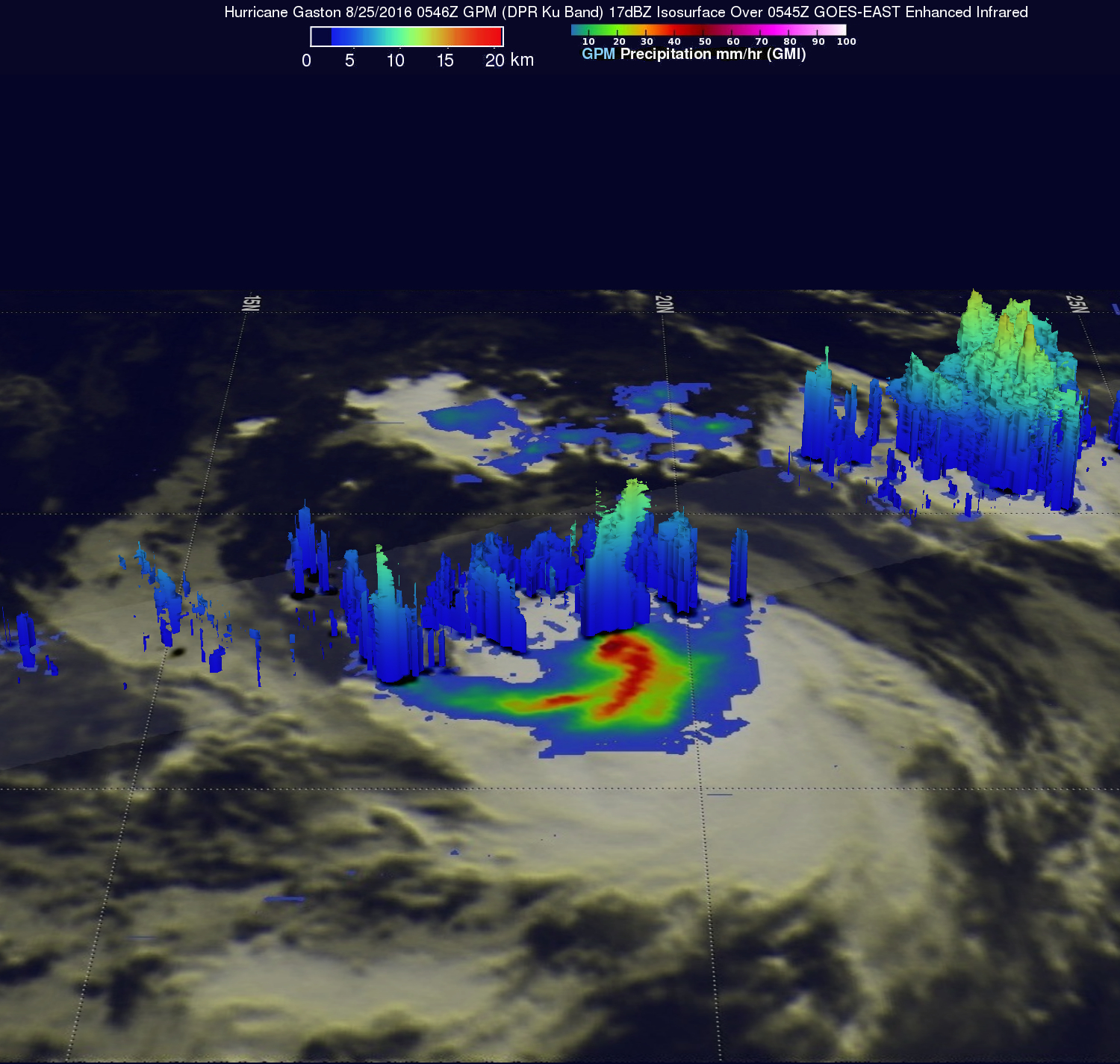
GPM captured this image of Gaston early this morning at 5:46 UTC (1:46 am EDT) soon after the storm became a hurricane. At the time of this image, the National Hurricane Center (NHC) reported that Gaston had maximum sustained winds of 75 mph, making it a minimal hurricane. The image shows rain rates derived from the GPM GMI (outer swath) and DPR (inner swath) overlaid on enhanced IR data from the GOES-East satellite. The image reveals both the presence of heavy rain with rates of around 50 mm/hr (~2 inches/hr, shown in dark red) near the center, which is fueling the storm, as well as the fact that the storm is very asymmetric with most of the rain (red, green and blue areas, indicating heavy, moderate and light rain, respectively) being located north and east of the low-level center of circulation, which reflects the effects of the southwesterly wind shear noted by NHC. These two opposing forces will determine Gaston's intensity over the coming days. Initially, Gaston should continue to feel the adverse effects of the wind shear; however, NHC is forecasting the shear to weaken after a day or so and for Gaston to become a hurricane once again as it moves over increasingly warmer waters. Gaston is expected to continue moving generally to the northwest over the next several days but remain east of Bermuda before turning back to the northeast.