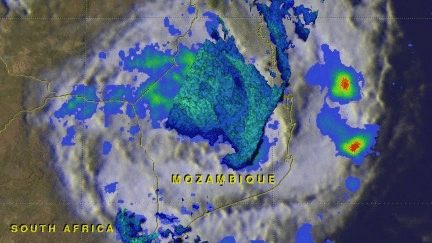
GPM Examines Deadly Tropical Cyclone Dineo
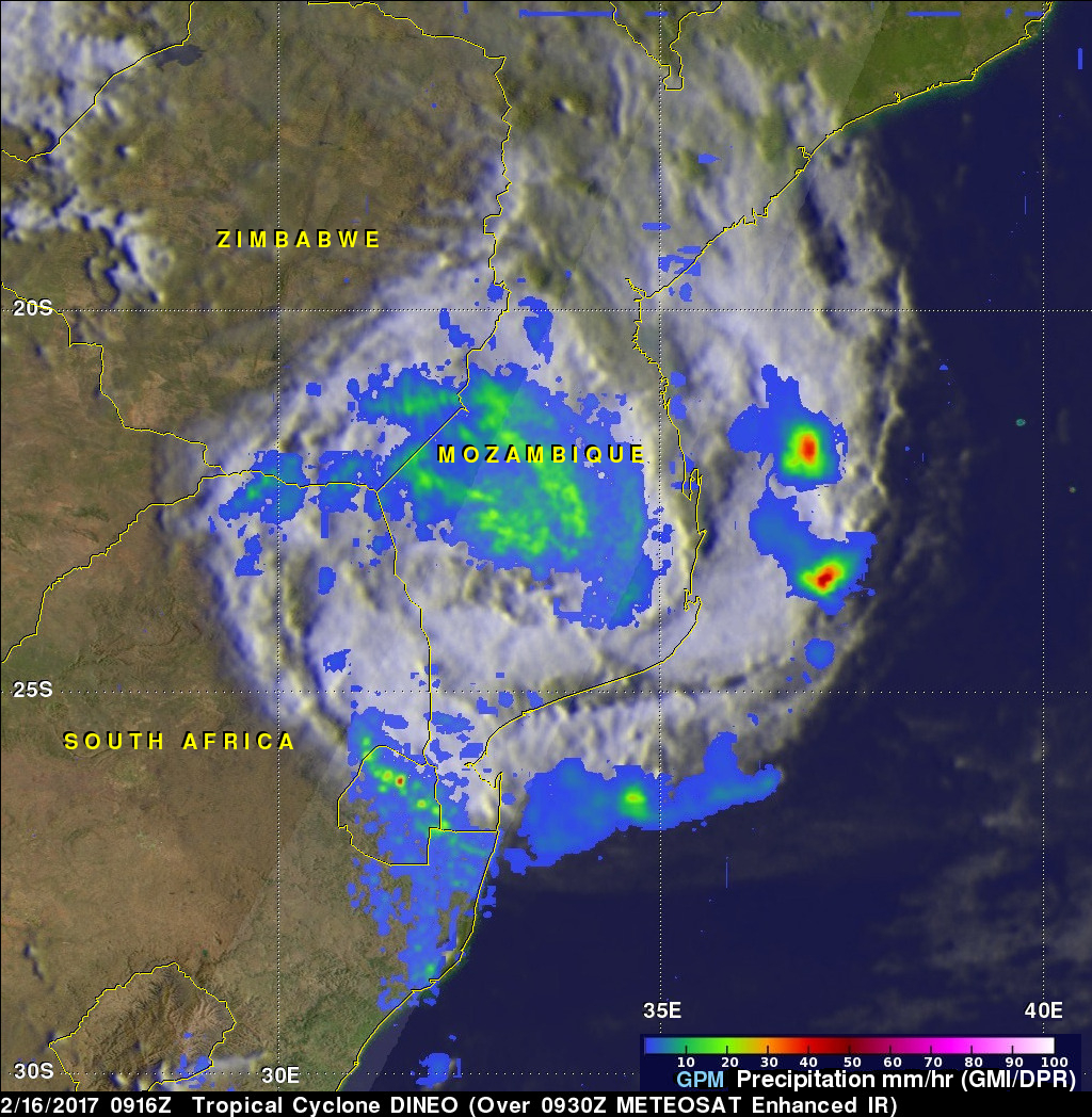
Dineo has now weakened to a tropical depression but the tropical cyclone had winds of over 70 kts (80.5 mph) when it hit Mozambique. Four people have been reported killed by Dineo. The GPM core observatory satellite flew over Mozambique on February 16, 2016 at 0916 UTC after Dineo's maximum sustained winds had fallen to about 60 kts (69 mph). Data collected by GPM's Microwave Imager (GMI) and Dual-Frequency Precipitation Radar (DPR) instruments showed that the tropical cyclone was still dropping light to moderate rainfall over a large area of southern Mozambique. This GPM view revealed that some of the most intense rain bands from Dineo had moved over Swaziland and northeastern South Africa. GPM found that a few powerful storms over Swaziland were dropping precipitation at a rate of over 86 mm (3.4 inches) per hour.
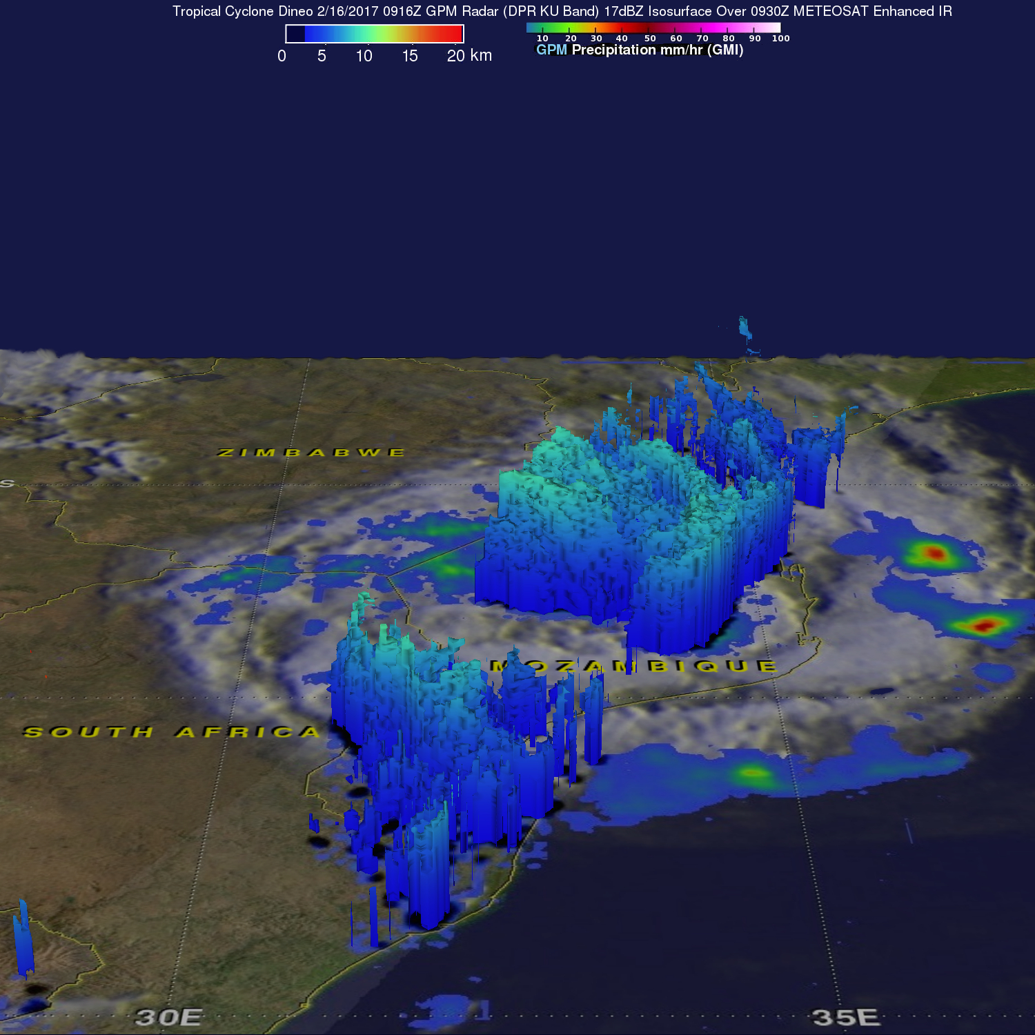
The GPM core observatory satellite's radar (DPR Ku Band) were used to show the 3-D structure of rainfall within tropical cyclone Dineo. Storm top heights were reaching heights above 16 km (9.9 miles) before the tropical cyclone came ashore in Mozambique. The tallest storm top heights in rain bands over Swaziland were shown by GPM's radar to reach heights of about 13.6 km (8.4 miles).