GPM Examines Deadly Typhoon Lan
Typhoon Lan caused flooding, landslides and the death of at least seven people when it hit Japan early Monday morning. The powerful typhoon was accompanied by high winds and extremely heavy rainfall. Rain totals of 800 mm (31.5 inches) were reported in parts of south central Honshu. Wind speeds of over 106 kts (121.9 mph) were also reported.
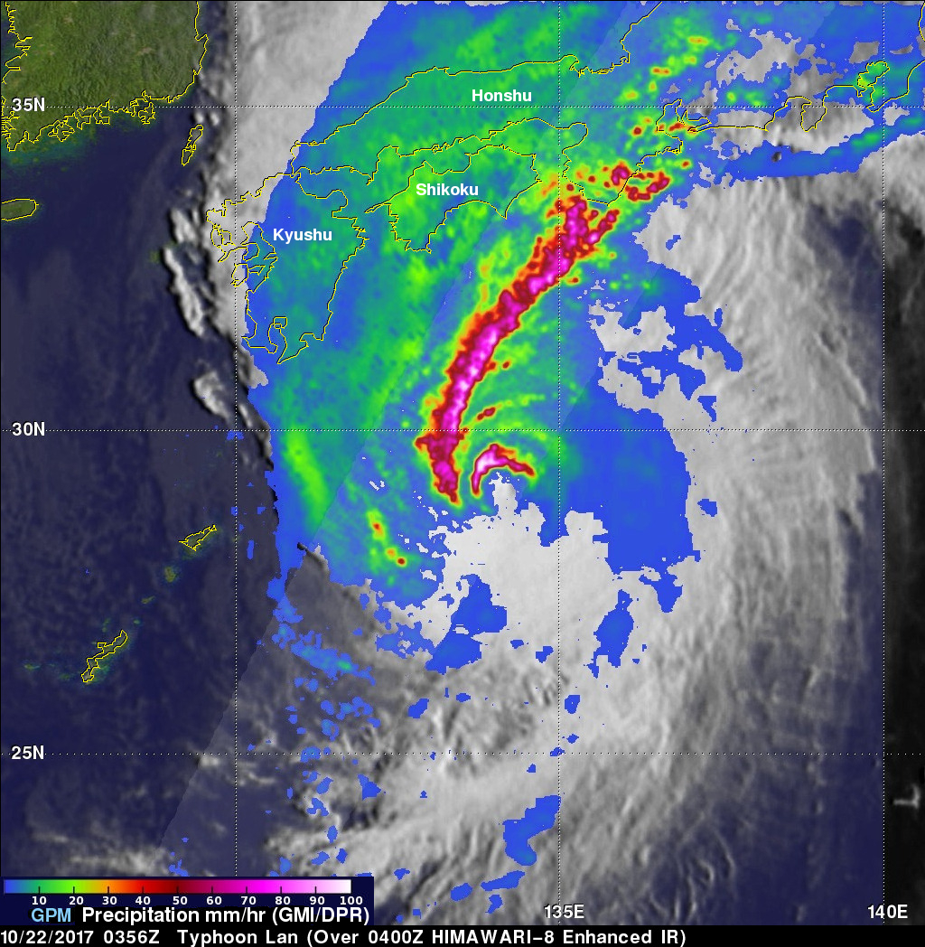
On October 22, 2017 at 0556 UTC the "core" satellite of the Global Precipitation Measurement (GPM) mission had an excellent view of Lan as the typhoon was approaching Japan. Data collected by GPM's Microwave Imager (GMI) and Dual-Frequency Precipitation Radar (DPR) instruments were used here to show the intensity of precipitation within the typhoon. GPM's radar (DPR ku Band) measured rain falling at the extreme rate of greater than 297 mm (11.7 inches) per hour in the northwestern side of the typhoon's eye wall. An extremely large and intense feeder band was shown extending from south-central Honshu to the western side of the powerful typhoon. The northwestern side of Lan's eye wall was still intact but GPM's radar showed that dry air was moving into the southeastern side of the eye causing it to erode.
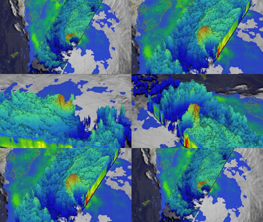
The GPM satellite's 3-D Radar data (DPR Ku Band) were used to probe the structure of precipitation around typhoon Lan's eye. Those data revealed the very powerful and tall thunderstorms that were located on the northwestern side of typhoon Lans' eye wall. A few storm tops in this area were found by DPR to reach altitudes above 16.9 km (10.5 miles). The break in the southeastern side of Lan's eye wall is shown by this view looking toward the northwestern side of the typhoon.
Typhoon Lan has moved over the open waters of the Pacific Ocean northeast of Japan. The weakening typhoon is expected to weaken to tropical storm intensity over the next few days.


