GPM Examines Forming Tropical Storm Nate (TD16)
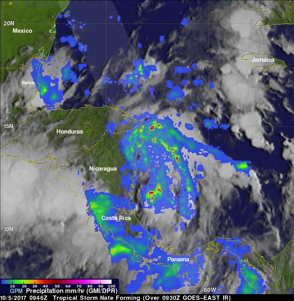
The GPM core observatory satellite passed above forming tropical storm Nate (TD16) on October 5, 2017 at 5:46 AM EDT (0946 UTC). TD16 was located in the western Caribbean near the coast of Nicaragua with winds of about 34.5 mph (30 kts). Data received by GPM's Microwave Imager (GMI) and Dual-Frequency Precipitation Radar (DPR) shows bands of rain producing heavy rainfall East of TD16's center of circulation. Downpours in the Caribbean Sea East of Nicaragua were measured by GPM's Radar (DPR Ku Band) dropping rain at a rate of over 6.4 inches (162 mm) per hour.

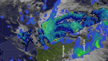
This close-up 3-d cross section view (looking toward the southeast) shows rainfall structure near TD16's center. It was created using data that was captured when the GPM satellite's radar (DPR Ku band) scanned precipitation in the center of the tropical cyclone. Storm tops within powerful convective storms located in rain bands in the northeastern semicircle of TD16 were shown by DPR reaching heights of 9.3 mile (15 km).
The National Hurricane Center (NHC) indicates that the tropical cyclone's future intensity is uncertain over the next couple days due to interaction with the coasts of Nicaragua, Honduras and then the Yucatan Peninsula. The tropical cyclone is forecast to strengthen as it moves over the Gulf of Mexico and could threaten the northern Gulf Coast as a category one hurricane this weekend. A recent NHC forecast track indicated that the possible hurricane would most affect coastal areas from Louisiana through the Florida panhandle.