GPM Examines Threatening Tropical Disturbance

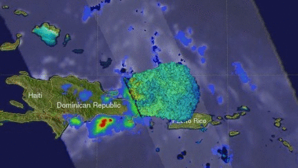
On August 25, 2016 at 0716 UTC (3:16 AM EDT) the GPM core observatory satellite had an excellent look at an area of low pressure associated with a tropical wave moving past the northern Dominican Republic. The National Hurricane Center (NHC) has been monitoring this area of disturbed weather for potential development into a tropical cyclone. This low is predicted by the NHC to produce heavy rainfall as it continues moving toward the northeast. The development of a tropical storm or hurricane moving in this direction could pose future danger to the Bahamas and the southeastern United States.
Rainfall data derived from data captured by the GPM satellite's Microwave Imager (GMI) and Dual-Frequency Precipitation Radar (DPR) instruments showed the extent of heavy precipitation in the tropical disturbance. GPM's DPR showed that some extremely powerful thunderstorms northeast of the Dominican Republic were dropping rain at a rate of almost 248 mm (9.8 inches) per hour.
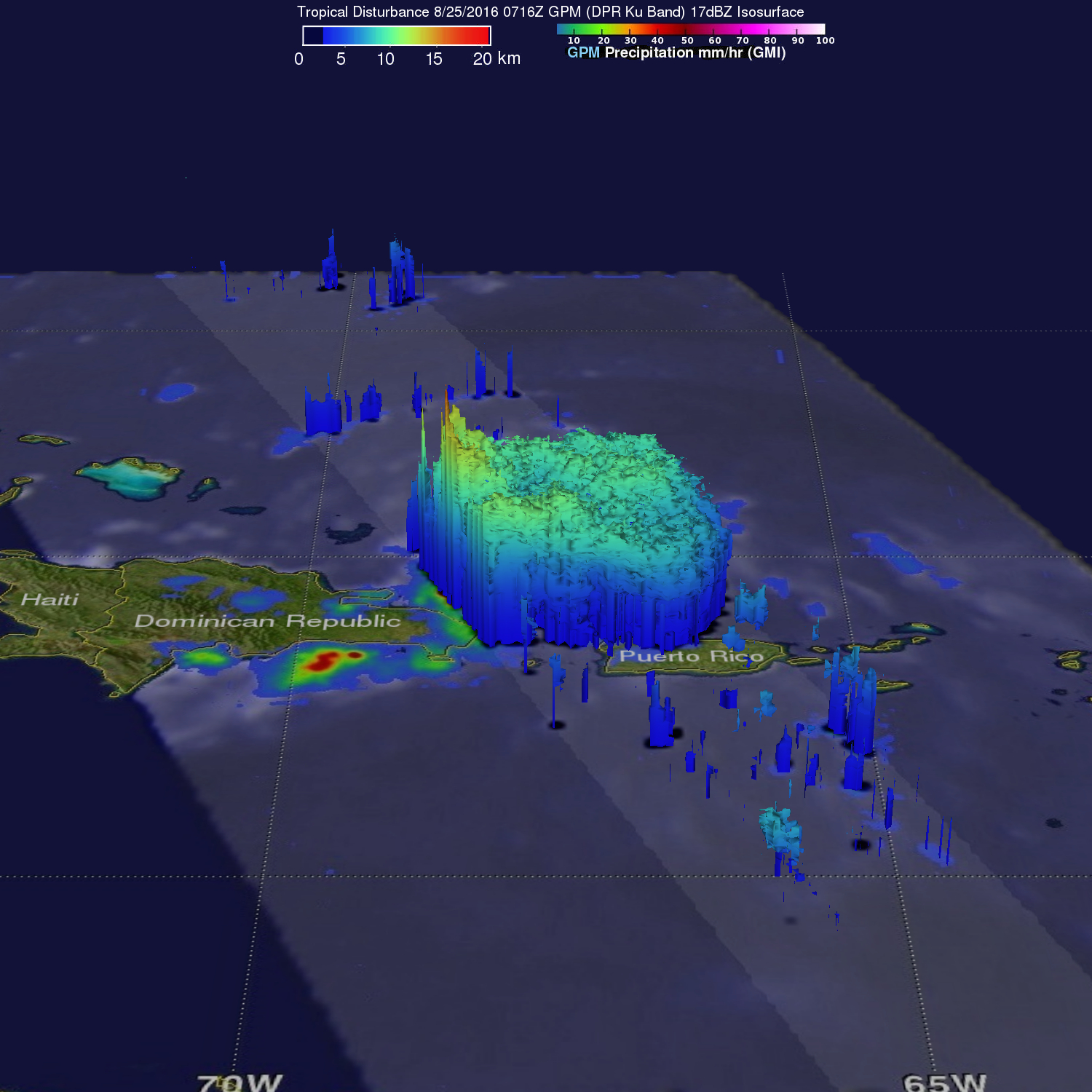
The GPM satellite's radar (DPR Ku Band) was used to create 3-D views of rainfall structure within the violent storms northeast of The Dominican Republic. DPR revealed that some storm tops in these intense storms were were reaching altitudes above 16 km (9.9 miles).