
GPM Examines Tropical Cyclone Uriah
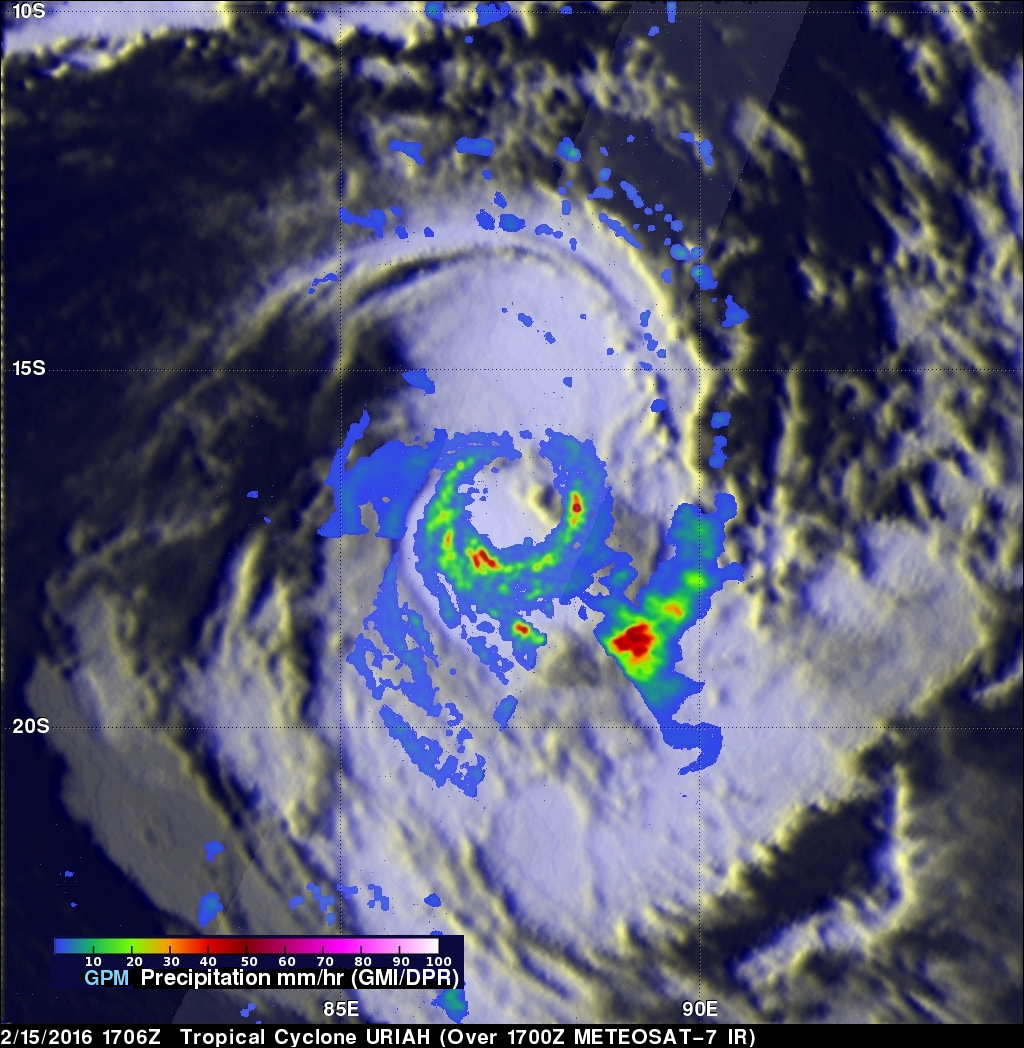
Over the past view days the GPM core observatory satellite has had good looks at tropical cyclone URIAH in the South Indian Ocean west of Australia. On February 15, 2016 at 1706 UTC GPM flew directly over the center of the tropical cyclone and measured rainfall in a well defined circulation. GPM's Dual-frequency Precipitation Radar (DPR) instrument discovered that rain was falling at a rate of over 127 mm (5 inches) per hour in a band of intense storms south of the cyclone's center.

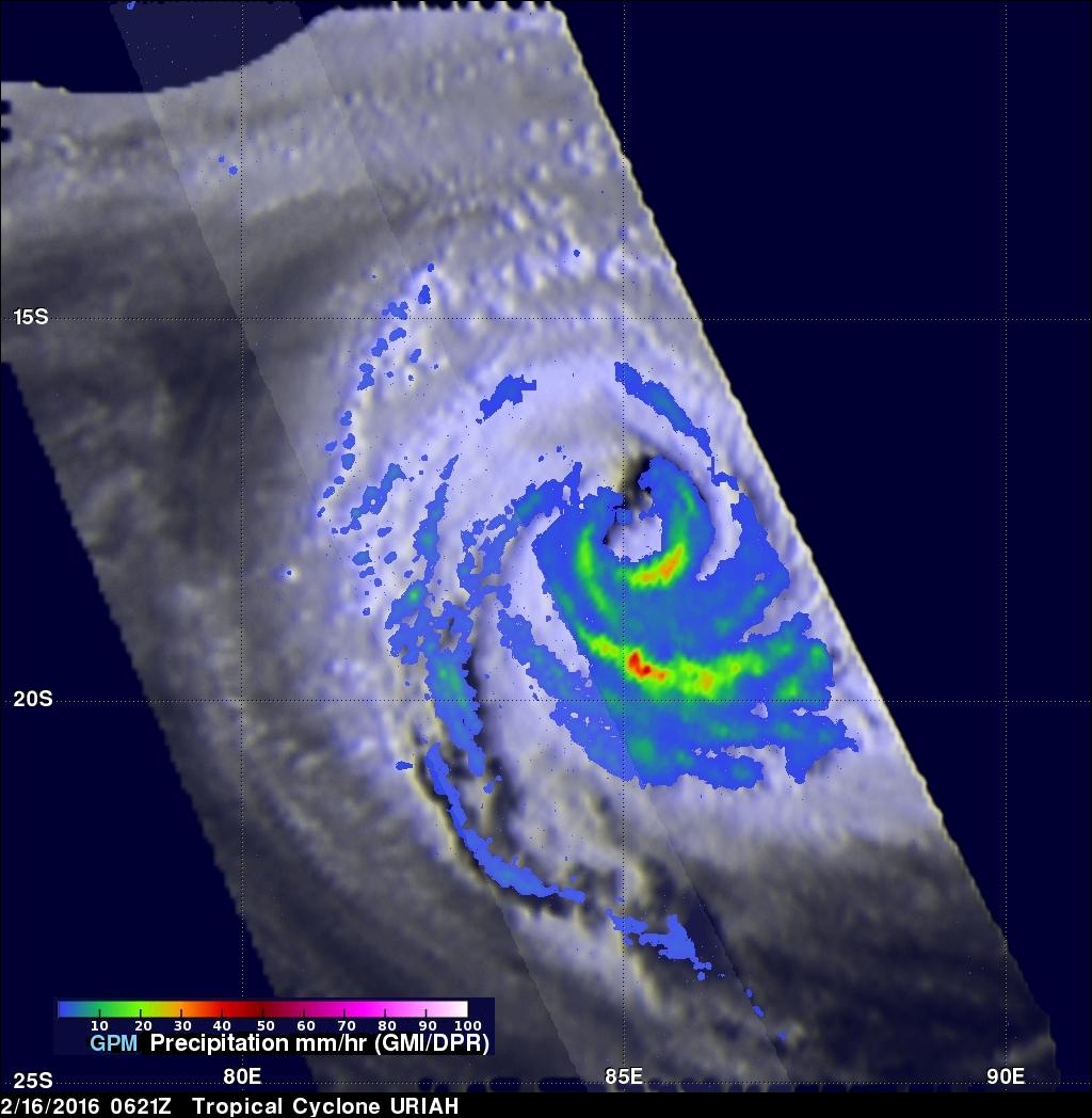
When GPM's Radar sliced through tropical storm URIAH on February 15, 2016 it also found that the intense convective thunderstorms moving around the southwestern side of the tropical cyclone were reaching heights above 16 km (9.9 miles). GPM once again flew over the intensifying tropical cyclone On February 16, 2016 at 0621 UTC when sustained winds had increased to about 55kts (63 mph). URIAH continued to intensify and later in the day had winds estimated at over 75kts (86mph) making it a category one on the Saffir-Simpson hurricane wind scale.
The Joint Typhoon Warning Center (JTWC) predicts that tropical cyclone URIAH will have peak wind speeds of 95 kts (109 mph) in a couple days. URIAH is then expected to gradually weaken as it heads southward over the open waters of the South Indian Ocean.