
GPM Finds Heavy Rain In Short Lived Tropical Cyclone Hilda
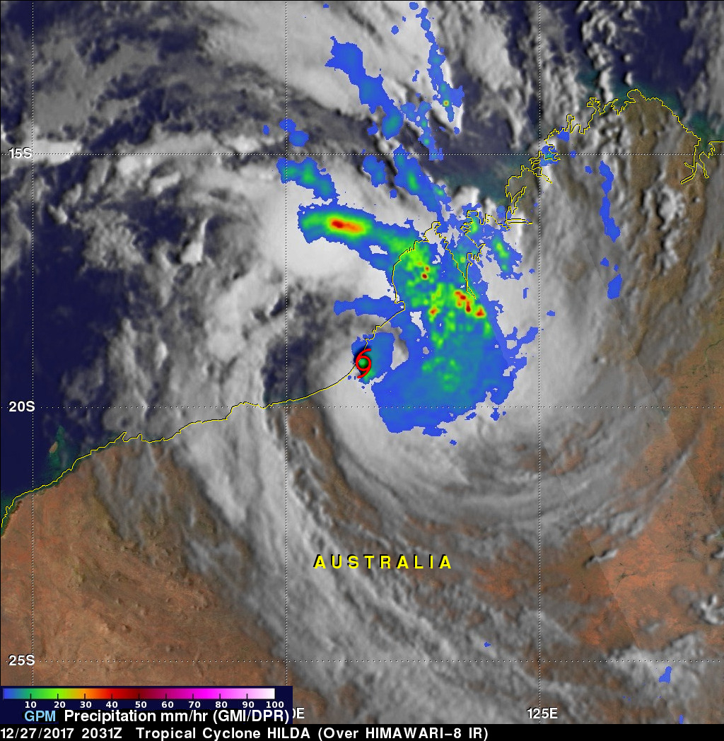
Tropical cyclone HILDA formed very close to Australia's northwestern coast on December 27, 2017 at 1800 UTC and dissipated quickly as it crossed over land. The GPM core observatory satellite had a good view of the short lived tropical cyclone on December 27, 2017 at 2031 UTC. A red tropical storm symbol shows HILDA's approximate location when GPM passed above. The center of GPM's coverage was mainly east of HILDA's center of circulation. The intensity of rainfall in a large intense band of storms wrapping around the northeastern side of the tropical cyclone was measured by the satellite's Microwave Imager (GMI) and Dual-Frequency Precipitation Radar (DPR) instruments. GPM's radar scanned the powerful convective storms in this band and found that a few storms were dropping precipitation at a rate of over 156 mm (6.1 inches) per hour. Heavy rain was reported as storms from the weakening tropical storm moved over the Kimberley region of Australia.
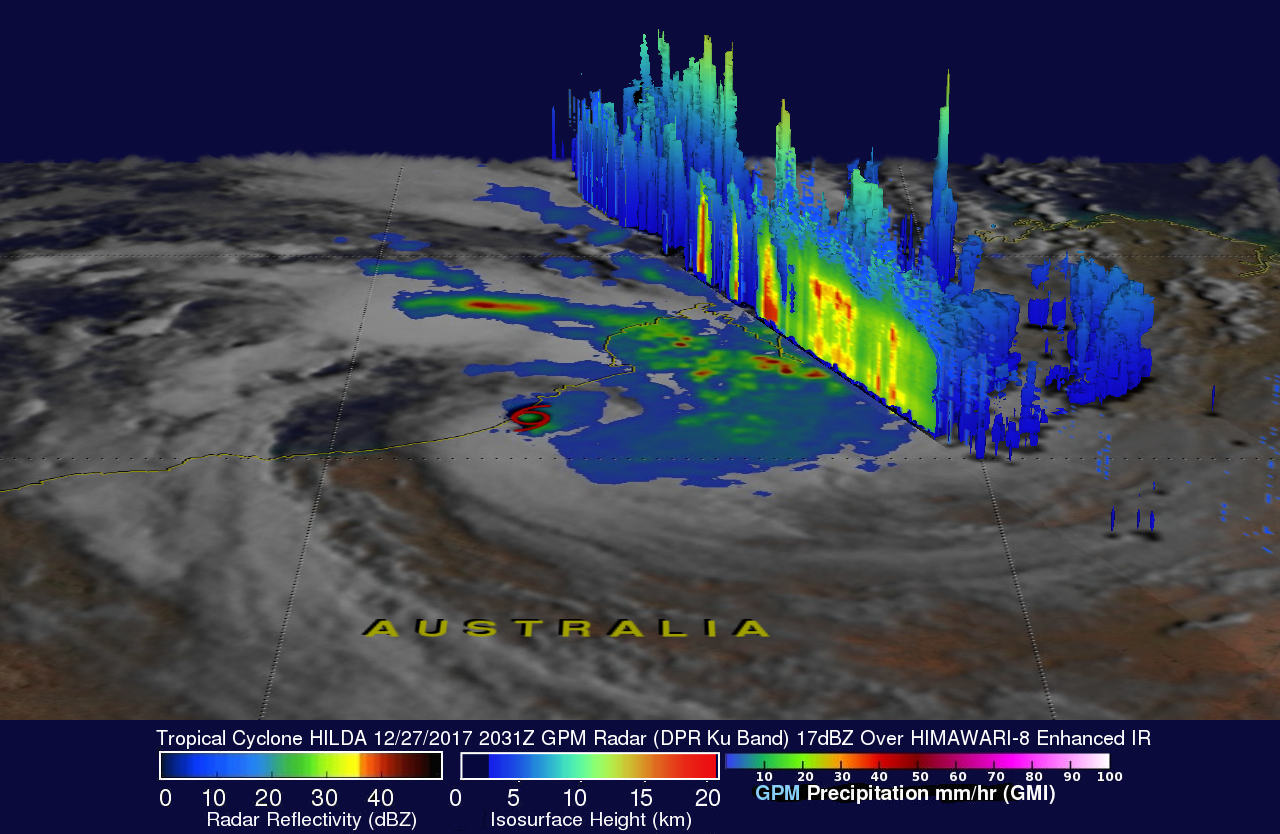
This 3-D view of the surface and upper level precipitation within tropical storm HILDA was derived from GPM's Radar (DPR Ku band). DPR's scans revealed that storm tops in bands of precipitation northeast of HILDA's center were reaching altitudes of over 17 km (10.5 miles).
The Joint Typhoon Warning Center (JTWC) issued it's last warning on dissipating tropical cyclone HILDA on December 28, 2017 at 0000 UTC.