
GPM Flies Over Intensifying Hurricane Aletta
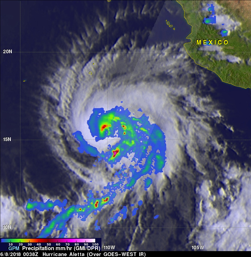
As expected, tropical storm Aletta intensified and became a hurricane. Aletta was a powerful hurricane with winds of about 85 kts (98 mph) when the GPM core observatory satellite passed over head on June 7, 2018 at 18:38 PM MDT (June 8, 2018 at 0038 UTC). GPM's Microwave Imager (GMI) and Dual Frequency Precipitation Radar (DPR) instruments showed that hurricane Aletta contained powerful storms that were producing heavy precipitation. Very strong convective storms were producing heavy rainfall in Aletta's eye wall while the most extreme downpours were shown in a large feeder band wrapping around the eastern side of the hurricane. GPM's radar (DPR Ku Band) data indicated that precipitation in that area was coming down at a rate of over 142 mm (5.6 inches) per hour.
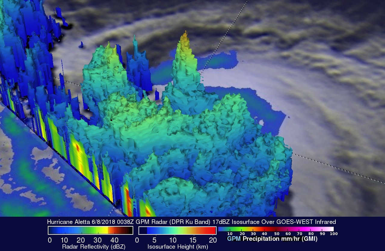
The western edge of the satellite's radar (DPR Ku Band) swath measured the intensity and heights of storms in hurricane Aletta's eastern eye wall. This 3-D cross-section view (looking toward the southwest) reveals that a few of these tall convective towers were reaching heights above 15 km (9.3 miles). The heat released by condensation within these tall thunderstorms provided fuel for Aletta's intensification.
View full screen in STORM Event Viewer
The National Hurricane Center (NHC) predicts that Aletta will move into an area of higher vertical wind shear and cooler sea surface temperatures this weekend. These environmental conditions are expected to cause Aletta to weaken significantly.