
GPM Flys Over Tropical Cyclone In Arabian Sea
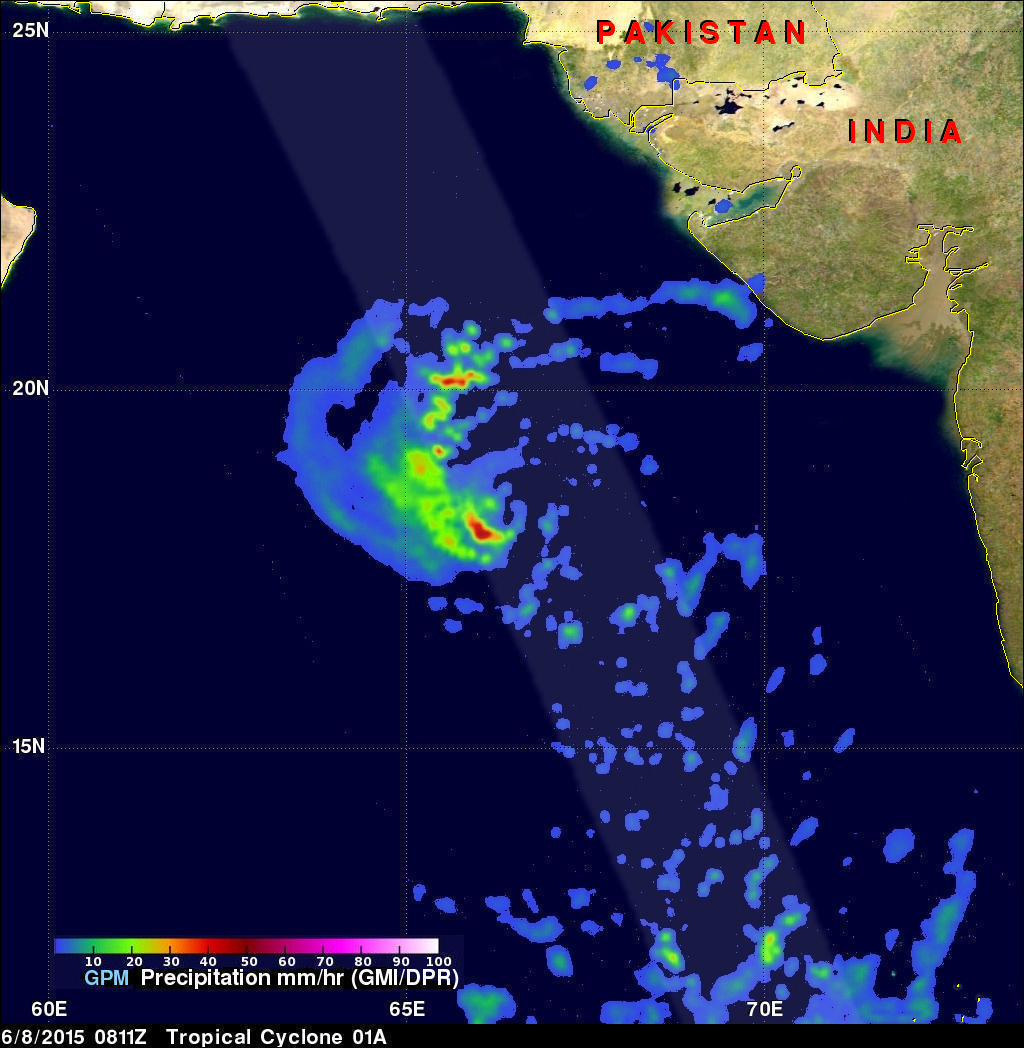
A rare tropical cyclone in the Arabian Sea west of India was seen by the GPM core observatory satellite when it flew over on the morning of June 8, 2015 at 0811Z. Tropical cyclone Ashobaa (TC01A) had sustained wind speeds of about 40 kts (46 mph) when the satellite passed over head.
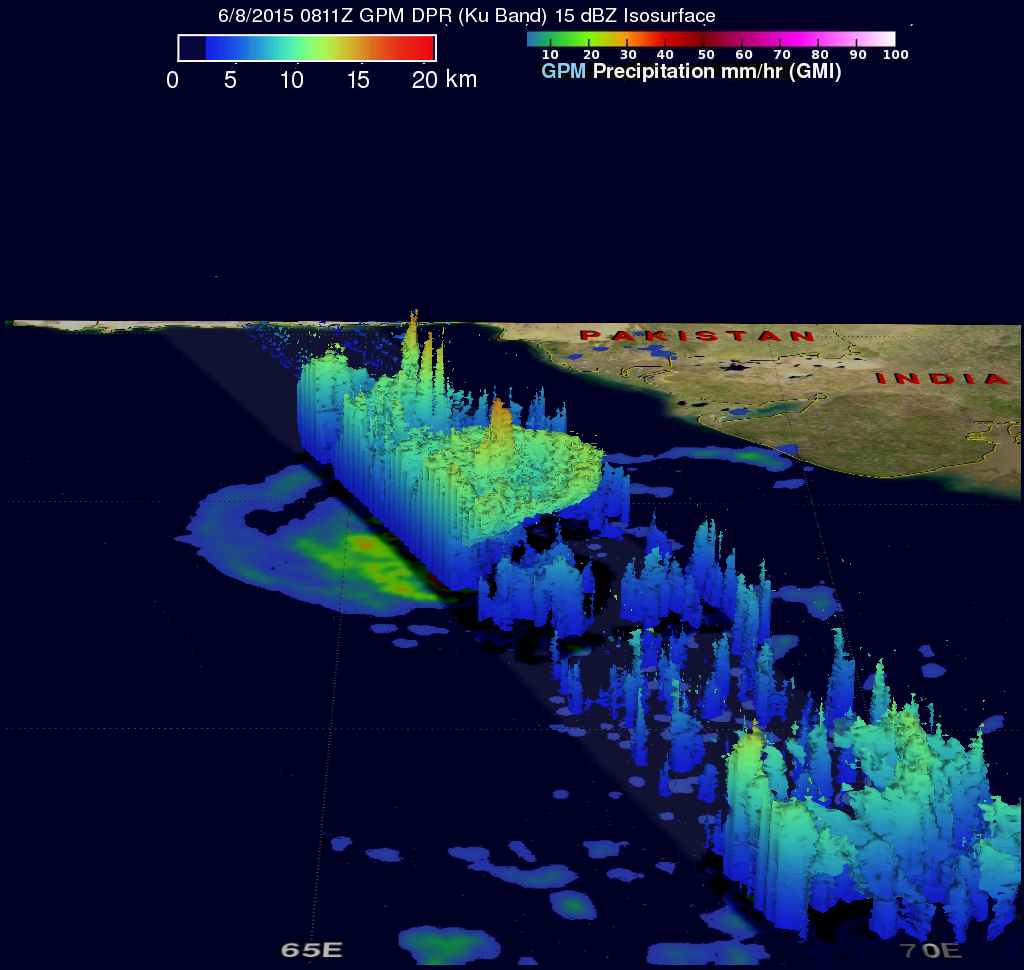
GPM's Microwave Imager (GMI) and Dual-Frequency Precipitation Radar (DPR) instruments measured rain falling at a rate of over 60 mm (2.3 inches) per hour in strong thunderstorms southwest of the storm's center of circulation. A 3-D view was constructed using data from DPR Ku band radar data. This 3-D view of GPM data reveals that Tropical cyclone Ashobaa (TC01A) had very powerful thunderstorms near the center of the newly formed storm reaching heights above 17km (10.5 miles). These tall thunderstorms near the center of a tropical cyclone can be a sign that intensification will occur in the future.
The Joint Typhoon Warning Center (JTWC) predicts that tropical cyclone Ashobaa will become more powerful and have winds of 65kts ( about 75 mph) in a couple days. Ashobaa is predicted to weaken after that as it heads toward the Gulf Of Oman in about five days.
Click here to see a simulated Low Resolution 640x360 Quicktime flyby.
Click here to see a simulated Low Resolution 640x360 MPEG flyby.