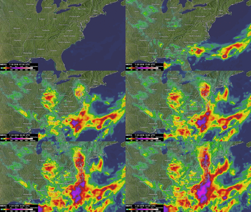
GPM IMERG Adds Up Heavy Rainfall Over the U.S. East Coast
A stalled weather pattern led to persistent showers and thunderstorms moving up the eastern seaboard last week, resulting in significant rainfall amounts and numerous flood warnings. A nearly stationary elongated upper-level trough of low pressure stretching down from the Great Lakes to Florida combined with a persistent Bermuda High off the coast to channel a steady flow of warm, humid air up the eastern seaboard. The result was a week of re-occurring showers and thunderstorms across the region.
The Integrated Multi-satellitE Retrievals for GPM or IMERG is used to estimate precipitation from a combination of passive microwave sensors, including GPM's GMI microwave sensor and geostationary IR (infrared) data. Accumulated IMERG rainfall estimates for the 1-week period 19 to 26 July 2018 show most of the eastern third of the US receiving some rain. The heaviest accumulations extend from the north-central Gulf of Mexico across northeast Florida, up along the coast of the Carolinas, through central Maryland and Pennsylvania and into central New York State. Early in the period, a stationary front draped across southern Georgia helped to focus showers and thunderstorms over north Florida and off the coast of South Carolina, while a trough of low pressure over the northern Gulf of Mexico did the same for that area. In the middle of the period, a wave of low pressure formed along the front over southeast Georgia and moved up the coast, then over the Chesapeake Bay, across central Pennsylvania and into central New York before weakening over the Great Lakes. This brought the first round of heavy rains to the Outer Banks of North Carolina, central Maryland and central Pennsylvania. After that more showers and thunderstorms formed in the moist southeast onshore flow, bringing additional rains to the coastal Carolinas and across the Piedmont into the Appalachians. The highest rainfall totals over land for the period are over the Outer Banks, central Maryland and central Pennsylvania where IMERG estimates are on the order of 180 mm or more (~7 inches, shown in purple). Numerous areas received on the order of 50 to 100 mm (~2 to 4 inches, shown in yellow and red) with locally higher amounts of up to 140 mm (~5.5 inches, shown in dark red) over northern Kentucky and parts of northern Florida.


