
GPM Measures Deadly Flooding Rainfall
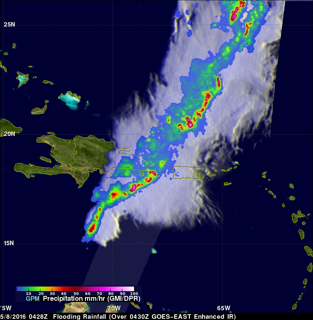
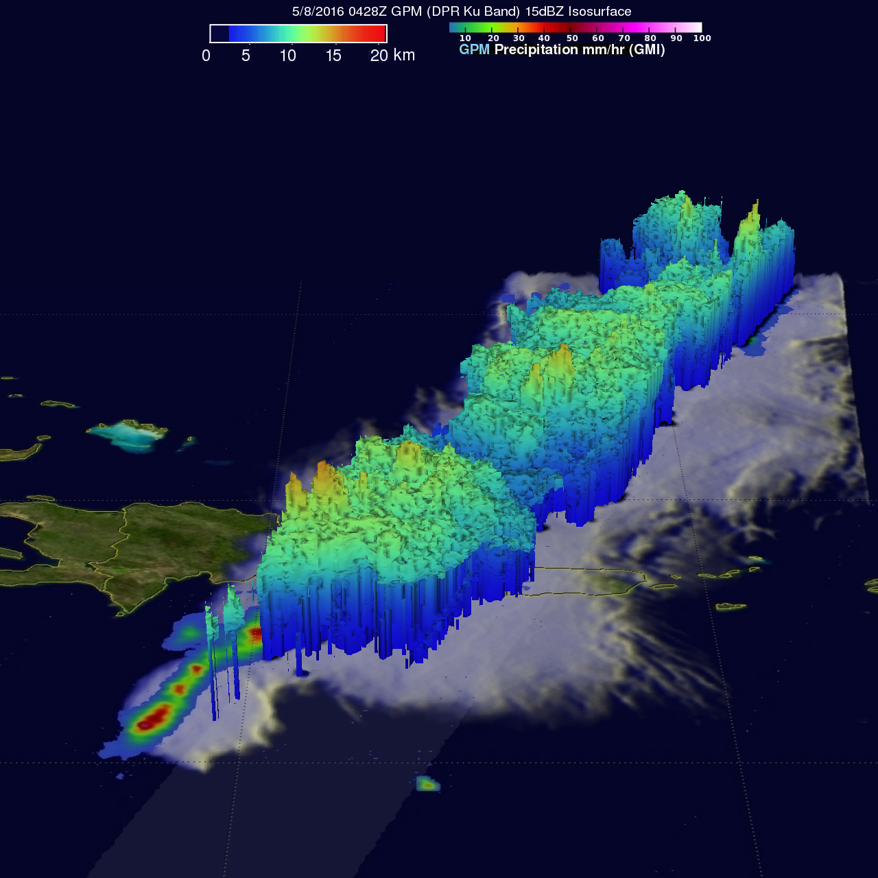
Over the past week extreme rainfall caused flooding that resulted in the deaths of four in Haiti and the evacuation of over 2500 people in the Dominican Republic. The GPM core observatory satellite saw a line of heavy rainfall on the eastern side of the Dominican Republic when it flew over on May 8, 2016 at 0428 UTC. GPM's Microwave Imager (GMI) and Dual-Frequency Precipitation Radar (DPR) instruments collected data that were used to estimate rainfall. This precipitation is shown on a top-down satellite view. Powerful storms were measured dropping rain at a rate of almost 300 mm (11.8 inches) per hour along this line of storms. GPM's Radar (DPR Ku Band) were used to measure the 3-D structure of precipitation in this area. Some tall thunderstorms north of Puerto Rico were measured by DPR reaching heights of over 16 km (9.9 miles).
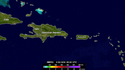
Data from NASA's Integrated Multi-satellitE Retrievals for GPM (IMERG) were used to estimate the amount of rain that fell over this area during the past week (May 2-9, 2016). The heaviest rainfall was estimated by IMERG to be over 300 mm (11.8 inches) in large areas of the eastern Dominican Republic.