GPM Observes Tropical Storm Gaston's Development
Tropical storm Gaston became the 7th named tropical storm in the Atlantic Ocean after forming southwest of the Cape Verde Islands on Monday evening August 22, 2016. Gaston's development followed closely behind tropical storm Fiona that formed in the same area southwest of the Cape Verde Islands on August 17, 2016. Fiona is now fading quickly in the Atlantic Ocean southwest of Bermuda. Tropical storm Gaston is predicted by the National Hurricane Center (NHC) to intensify and become a hurricane on August 24, 2016. Gaston is expected to move into the center of the Atlantic Ocean well east of Bermuda during the next five days and is predicted to intensify and have winds of over 85 kts ( 98 mph) tomorrow.
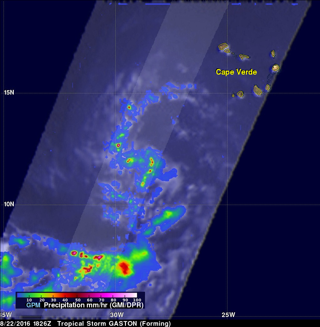
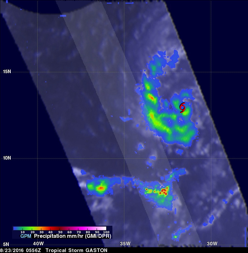
The GPM core observatory satellite had a very good view of forming tropical storm Gaston on August 22, 2016 at 1826 UTC. At that time the forming tropical storm was starting to get organized with bands of showers moving around the center of the low's circulation. The GPM satellite had a fairly good view when it flew over newly formed tropical storm Gaston on August 23, 2016 at 0556 UTC. A red tropical storm symbol shows the location of the Gaston's closed circulation center.
Measurements of precipitation with Gaston were derived from GPM's Microwave Imager (GMI) and Dual-Frequency Precipitation Radar (DPR) instruments. The GPM satellite had the best examination of rainfall around the tropical cyclone when it flew over the low's center on August 22, 2016. The heaviest precipitation was found by GPM in an area of intense convective storms located well to the southwest of the low. DPR measured rain there falling at a rate of over 141 mm (5.6 inches) per hour.
![]()
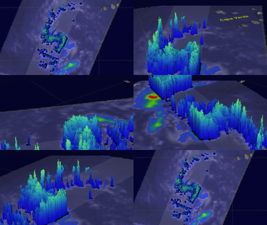
GPM's Radar (DPR Ku Band) made measurements of the intensity of rainfall and heights of storms near the developing tropical storm. 3-D measurements by DPR found that some storm tops around the developing tropical storm were reaching altitudes above 14.7 km (9.1 miles).


