
GPM Passes Over Weakening Hurricane John
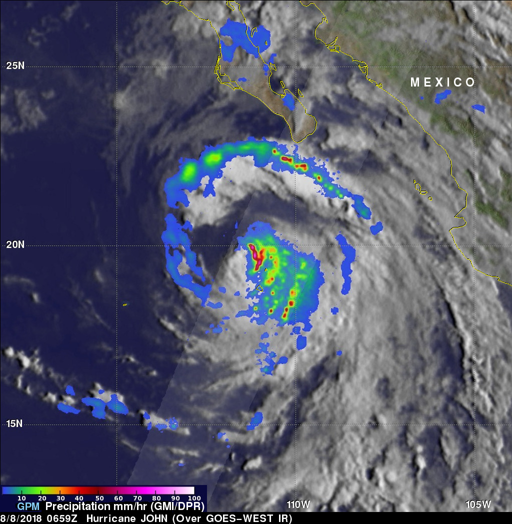
The GPM core observatory satellite provided very good coverage of hurricane JOHN when it passed above the eye of the tropical cyclone on August 8, 2018 at 0:59 AM MDT (0659 UTC). JOHN's maximum sustained wind speeds had started to decrease. GPM's Microwave Imager (GMI) and Dual-Frequency Precipitation Radar (DPR) instruments showed that most of JOHN's precipitation was then located in the eastern half of the hurricane. A large cloud free area had developed between the center of the hurricane and an intense feeder band wrapping around the northern and western side of the hurricane. GPM's radar (DPR Ku Band) revealed that extremely heavy rainfall was still falling at a rate of over 202 mm (almost 2 inches) per hour just east of JOHN's eye.
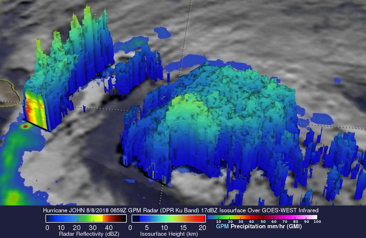
This 3-D cross-section through hurricane JOHN's precipitation was derived from GPM radar data (DPR Ku Band). Those data showed that the tops of powerful storms in the eastern side of JOHN's eye wall were reaching altitudes of about 12 km (7.4 miles). Storms in the intense feeder band well north of JOHN's eye were even higher. Probes by GPM's radar showed that storms in that area that were reaching heights above 13.5 km (8.4 miles).
The National Hurricane Center (NHC) predicts that Hurricane JOHN will gradually weaken as it moves northwestward over cooler ocean waters. JOHN is expected to stay well off shore of the Baja California Peninsula and it's winds are expected to weaken to below 60 kts (69 mph) after tomorrow.