
GPM Probes Powerful Tropical Cyclone Cebile

Tropical Cyclone CEBILE formed four days ago in the southwest Indian Ocean southeast of Diego Garcia. Today CEBILE became the most powerful tropical cyclone to form in the southern hemisphere this year. Maximum sustained wind speeds within CEBILE were estimated at 120kts (138 mph) early today making CEBILE the equivalent of a category 4 hurricane on the Saffir-Simpson hurricane wind scale.
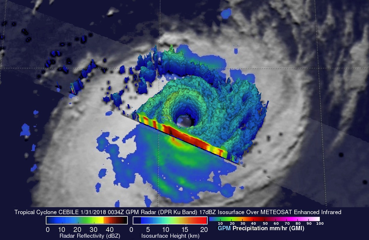
The GPM core observatory satellite passed directly above the well defined circular eye of tropical cyclone CEBILE on January 31, 2018 at 0034 UTC. Rainfall intensity and coverage within CEBILE were revealed by GPM's Microwave Imager (GMI) and Dual Frequency Precipitation Radar (DPR) instruments. GPM's GMI and DPR showed that intense thunderstorms on the southern side of CEBILE's nearly clear eye were dropping rain at a rate of more than 228 mm (9 inches) per hour.
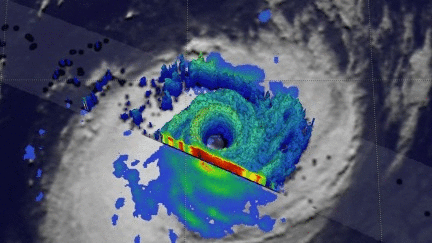
GPM's Dual Frequency Precipitation Radar (DPR) data were used to show 3-D cut-a-way views of the precipitation structure within tropical cyclone CEBILE. Heavy downpours within the tropical cyclone were frequently returning radar reflectivity values greater than 54 dBZ to the satellite. GPM's radar also showed that tall thunderstorms in CEBILE's eye wall were reaching heights above 14.4 km (8.9 miles).
Today tropical cyclone CEBILE is moving through an environment that is very favorable for maintaining the tropical cyclone's power. Low vertical wind shear and very warm ocean temperatures are having a positive effect on CEBILE. The Joint Typhoon Warning Center (JTWC) predicts that this will change tomorrow. Vertical wind shear is expected to increase and cooler waters are predicted to sap the power of the tropical cyclone.