
GPM Radar Shows Tornado Spawning Thunderstorms
Tornadoes were reported yesterday evening in Illinois, Indiana and Ohio. At least nine twisters were reported between 1:40 PM EST and 6:22 EST (1840 - 2322 utc). This unsettled weather caused many customers to lose electric power in northern Ohio. One powerful storm injured eight people in the northern Ohio town of Celina. The severe weather may also be the cause of two deaths in Erie Pennsylvania.
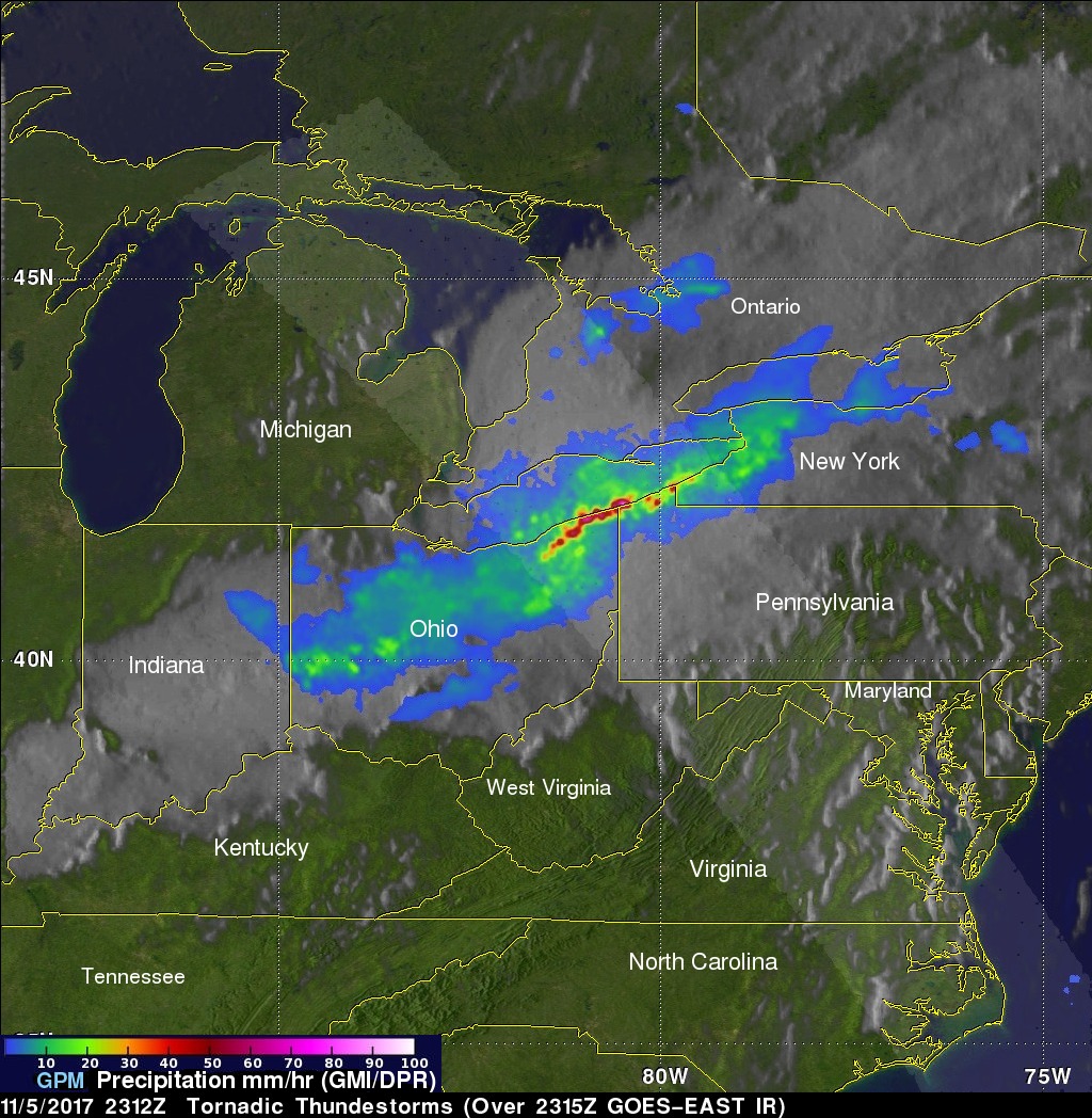
The GPM core observatory satellite had an exceptional view of the extreme weather in northeastern Ohio on Sunday November 5, 2017 at 6:12 PM EST ( 2312 UTC). The GPM satellite scanned tornado spawning thunderstorms that were moving eastward over southern Lake Erie. GPM's Microwave Imager (GMI) and Dual Frequency Precipitation Radar (DPR) revealed the locations of heavy rainfall in intense storms extending from Indiana through western New York. The area of coverage for the GPM satellite's radar is shown in lighter shades. GPM'S radar (DPR Ku band) showed that some storms near the northeastern Ohio and northwestern Pennsylvania borders were dropping rain at a rate of greater than 3.6 inches (92 mm) per hour.
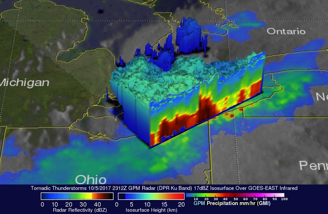
GPM's radar data (DPR Ku Band) were used in this 3-D "cut-away" view. GPM data revealed the locations of heavy precipitation inside storms that were occurring over northeastern Ohio. These slices revealed that downpours within these storms were frequently returning radar reflectivity values greater than 50dBZ to the satellite. This probe by the GPM satellite's radar uncloaked storm tops that were reaching heights above 6.7 miles (10.8 km).