
GPM Satellite Examines Tornadic Thunderstorms
Over the past few days tornado spawning thunderstorms have occurred in the states of Texas, Oklahoma, Arkansas, Louisiana, Indiana, Mississippi, Alabama and Georgia. Large hail, damaging winds, and flash flooding associated with a frontal system moving across the United States have compounded the damage from these storms. Hail the size of a half-dollar was reported near Jackson, Louisiana on Thursday evening.
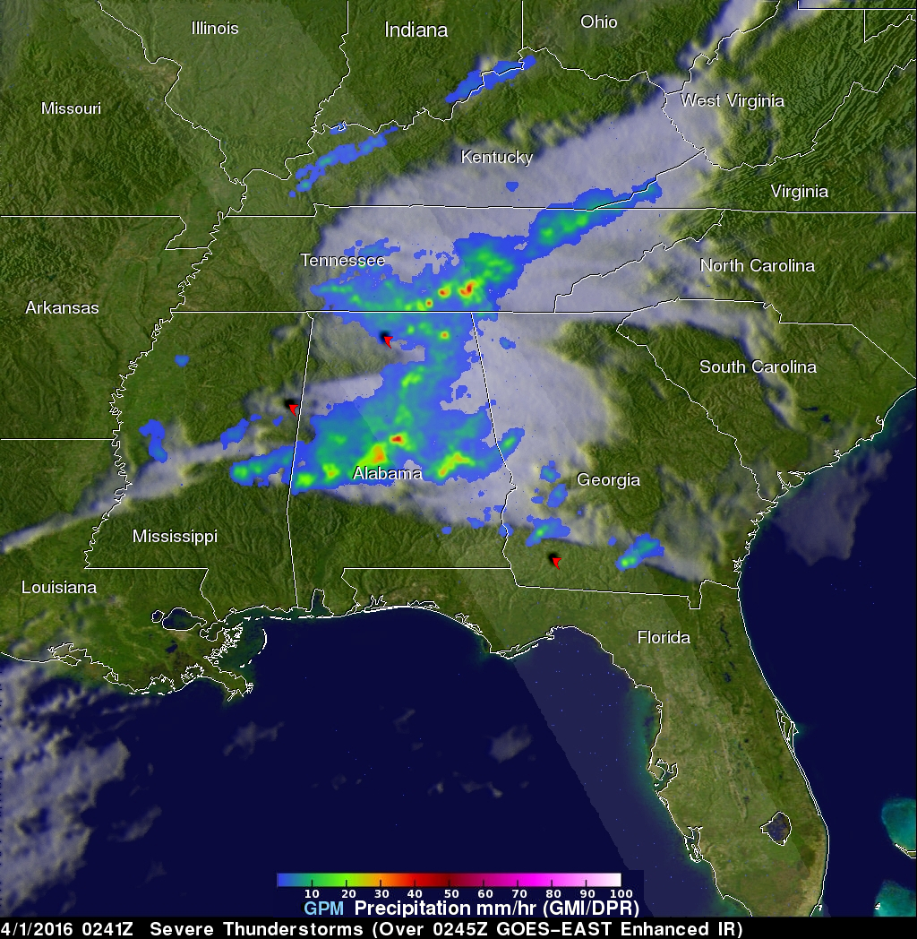
The GPM core observatory satellite flew over this stormy area on April 1, 2016 at 0241 UTC (March 31, 2016 at 10:41 PM EDT). Tornadoes were reported in Mississippi, Alabama and Georgia during the evening. A tornado was reported near Hartselle, Alabama less than an hour before the satellite passed over. This rainfall analysis was derived from data collected by GPM's Microwave Imager (GMI) and Dual-Frequency Precipitation Radar (DPR) instruments. The locations of some tornadoes reported last night are shown on this image. GPM radar (DPR) measured rain falling at the extreme rate of over 91 mm (3.6 inches) per hour in a powerful storm east of Chattanooga, Tennessee. The lighter strip shows the location of GPM's radar coverage.
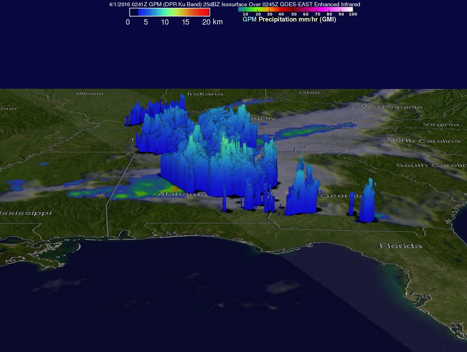
Data from the GPM satellite's radar (GPM Ku band) were used to reveal the three dimensional structure of precipitation in storms beneath the satellite. GPM's radar found that storm tops in Alabama were reaching heights above 12 km(7.4) miles. The locations of intense storms were also revealed by this 3-D slice which shows radar echoes greater than 25 dBZ (decibels Z).