
GPM Satellite Reveals Intensity Of Powerful Storms In The Timor Sea

The GPM satellite flew over a stormy area of the Timor Sea northwest of Australia on February 7, 2017 at 1926Z. GPM found that this stormy area contained some extremely powerful convective storms. GPM's Dual-Frequency Precipitation Radar (DPR) found that the most intense storms were dropping rain at a rate of over 268 mm (10.6 inches) per hour.
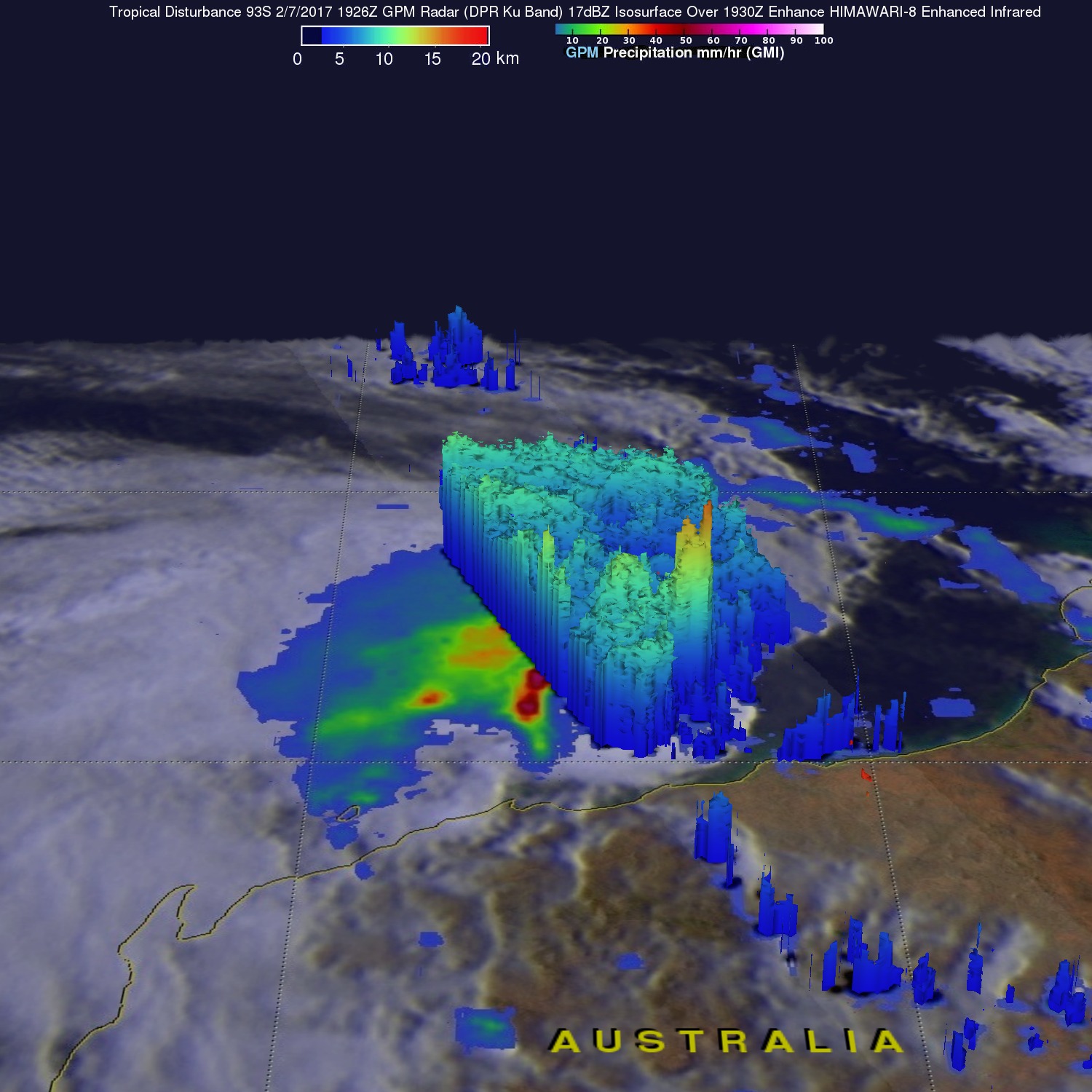
Data received by GPM's Radar (DPR Ku Band) also revealed the 3-D anatomy of precipitation hidden inside these unusually powerful storms. GPM's radar found that these storm tops were pushing to altitudes greater than 19 km (11.8 miles). GPM radar data also showed that some intense precipitation in these storms was returning radar reflectivity values of over 88 dBZ to the satellite.
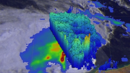
Tropical cyclones frequently form off the northwestern coast of Australia at this time of year. This cluster of intense tropical convection isn't expected to become a tropical cyclone because it is moving over cooler sea surface temperatures in the near future.