GPM Satellite Sees Tropical Storm Irma Forming Near Cape Verde Islands
The National Hurricane Center (NHC) upgraded a low pressure area in the far eastern Atlantic Ocean to tropical storm Irma on August 30, 2017 at 11:00 AM AST (1500 UTC). Tropical cyclones that form in that part of the Atlantic Ocean are often the largest and most powerful hurricanes of the season. Hurricanes Ivan (2004), Isabel (2003), Hugo (1989) and Allen (1980) are examples of past powerful hurricanes that formed near the Cape Verde islands.
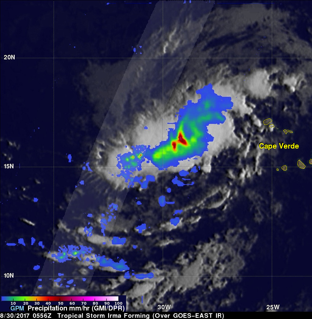
The GPM core observatory satellite flew above forming tropical storm Irma on August 30, 2017 at 1:56 AM EDT (0556 UTC). This new tropical cyclone was forming from a tropical wave that was passing to the east of the Cape Verde islands. Scans by GPM's Microwave Imager (GMI) and Dual-Frequency Precipitation Radar (DPR) instruments (shown in lighter shades) revealed that heavy rain was falling in this area of strong convective storms. Rain falling at a rate of over 2.6 inches (66 mm) per hour was indicated by GPM's GMI. DPR scanned storms to the west of the center of circulation and found rain dropping at at rate of over 4.96 inches (126 mm) per hour. GPM's radar (DPR Ku band) showed that heights of convective storm tops located to the west of the forming tropical storm were reaching altitudes above 8.2 miles (13.2 km).
The National Hurricane Center (NHC) indicates that Irma is moving toward the west-northwest. Tropical storm Irma is predicted to become more powerful and be a hurricane in a couple days. Irma is then expected to stay at low latitudes next week while approaching the Lesser Antilles.


