GPM Says Goodbye to Tropical Storm Molave
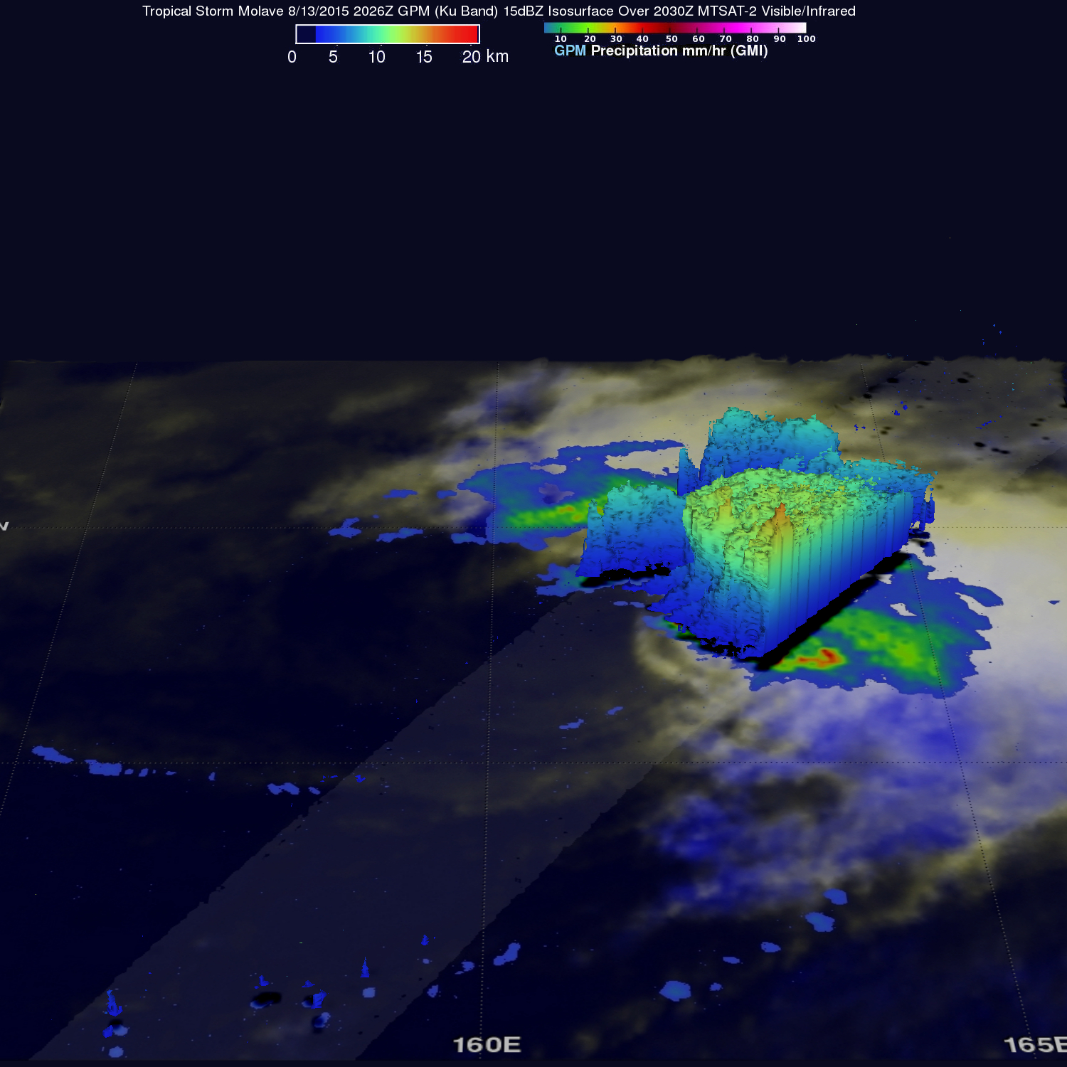
Tropical storm Molave became the 16th named tropical cyclone when it formed on August 7, 2015 and spent the past week over the open waters of the Pacific Ocean. For a few days Molave moved toward Japan but re-curved toward the northeast and passed well to the southeast of Japan. Molave became an extratropical cyclone and the Joint Typhoon Warning Center (JTWC) issued it's last warning on August 13, 2015 at 2100 UTC. Molave was last seen as a tropical storm by the GPM core observatory satellite on August 13, 2015 at 2026 UTC.
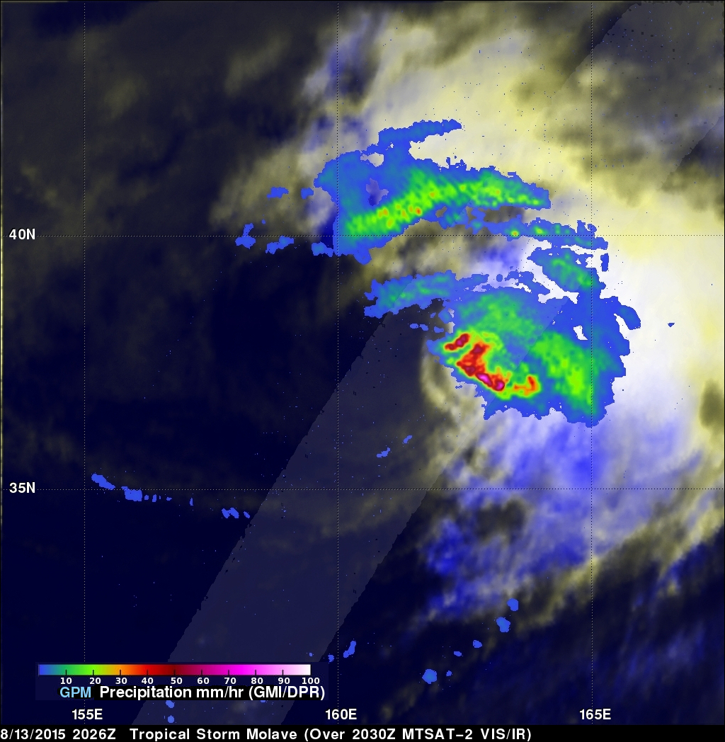
Molave's rainfall intensity was measured with this satellite pass by GPM's Microwave Imager (GMI) and Dual-Frequency Precipitation Radar (DPR) instruments. Data collected with that pass showed that Molave still contained some potent storms. Rain in some powerful storms northeast of the Molave's center of circulation was shown by DPR to be falling at a rate of over 115 mm (5.5 inches) per hour. As seen in a simulated 3-D view, GPM's Ku band radar measured storm top heights in that area reaching altitudes above 15 km (9.3 miles).