GPM See Potential Tropical Cyclone
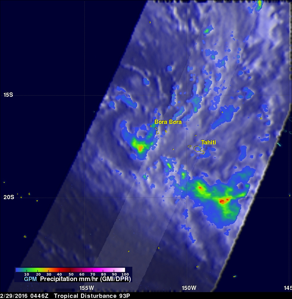
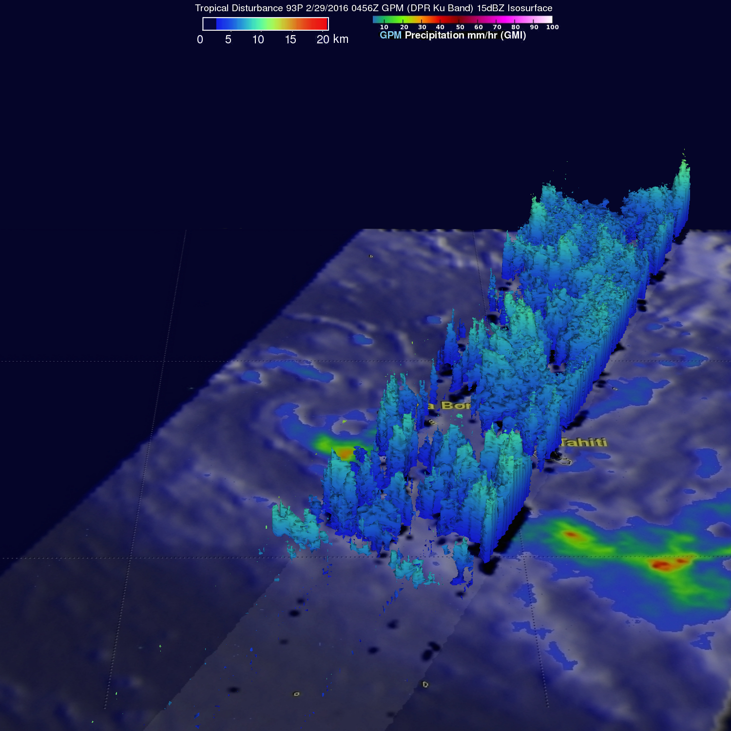
The GPM core observatory satellite flew over an area of disturbed weather in the South Pacific near Bora Bora early today where a tropical cyclone may be forming. On February 29, 2016 at 0456 UTC GPM's Microwave Imager (GMI) saw rain falling at an estimated rate of almost 48 mm (1.9 inches) per hour in an area of deep convection south of a tropical low. GPM's Dual-frequency Precipitation Radar (DPR) instrument measured cloud top heights at an altitude of over 10.5 km (6.5 miles) in rain showers between Bora Bora and Tahiti.
Images and caption by Hal Pierce (SSAI/NASA GSFC)


