
GPM Sees Chapala Traveling Toward Yemen
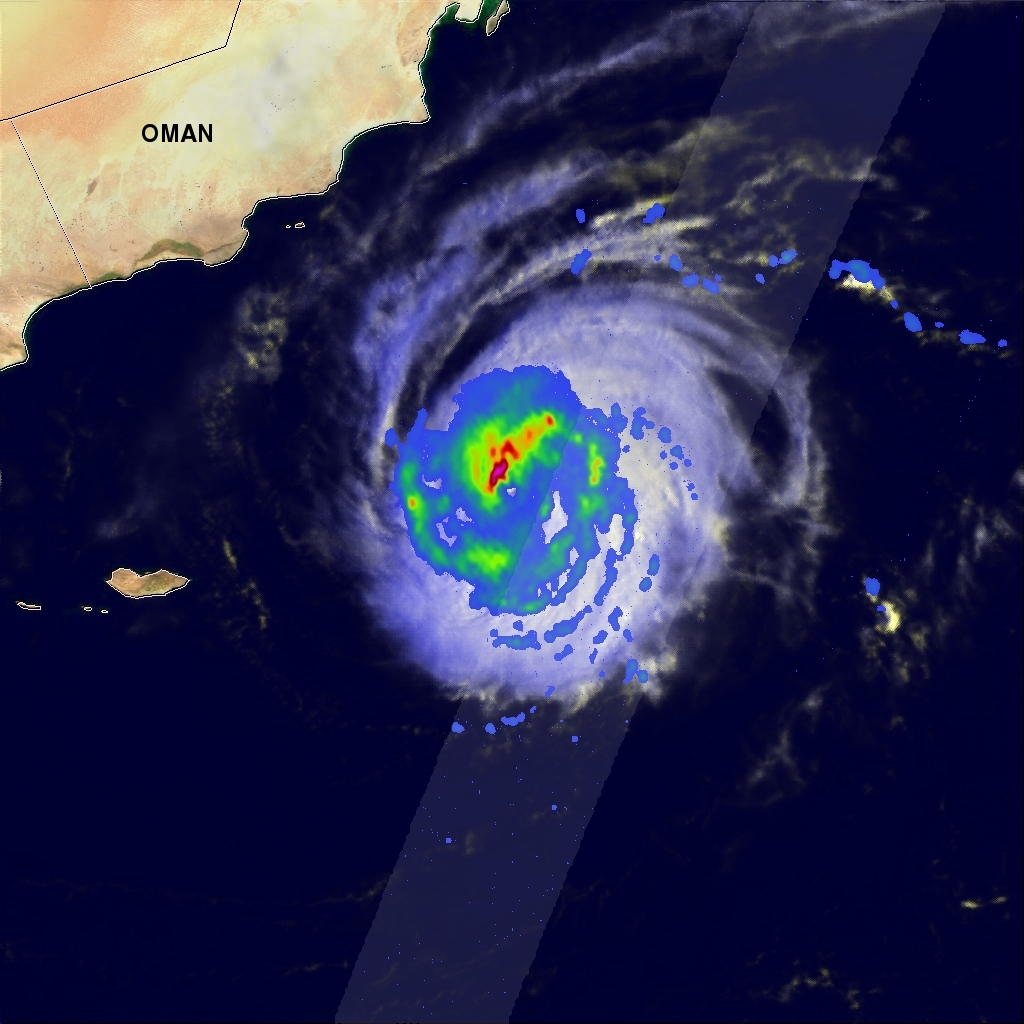
Powerful tropical cyclone Chapala continues moving inexorably toward Yemen. Chapala has weakened from category four intensity a couple days ago while maintaining a course that steers it toward Yemen. The GPM core observatory satellite had a good look at tropical cyclone Chapala on October 31, 2015 at 0331 UTC. GPM's rainfall data are shown overlaid on a 0330Z METEOSAT-7 Visible/Infrared image. At that time Chapala was a very powerful tropical cyclone with maximum sustained winds of about 117 kts (135 mph). GPM's Microwave Imager (GMI) instrument measured rain dropping at a rate of over 88 mm (3.5 inches) per hour northwest of Chapala's eye.
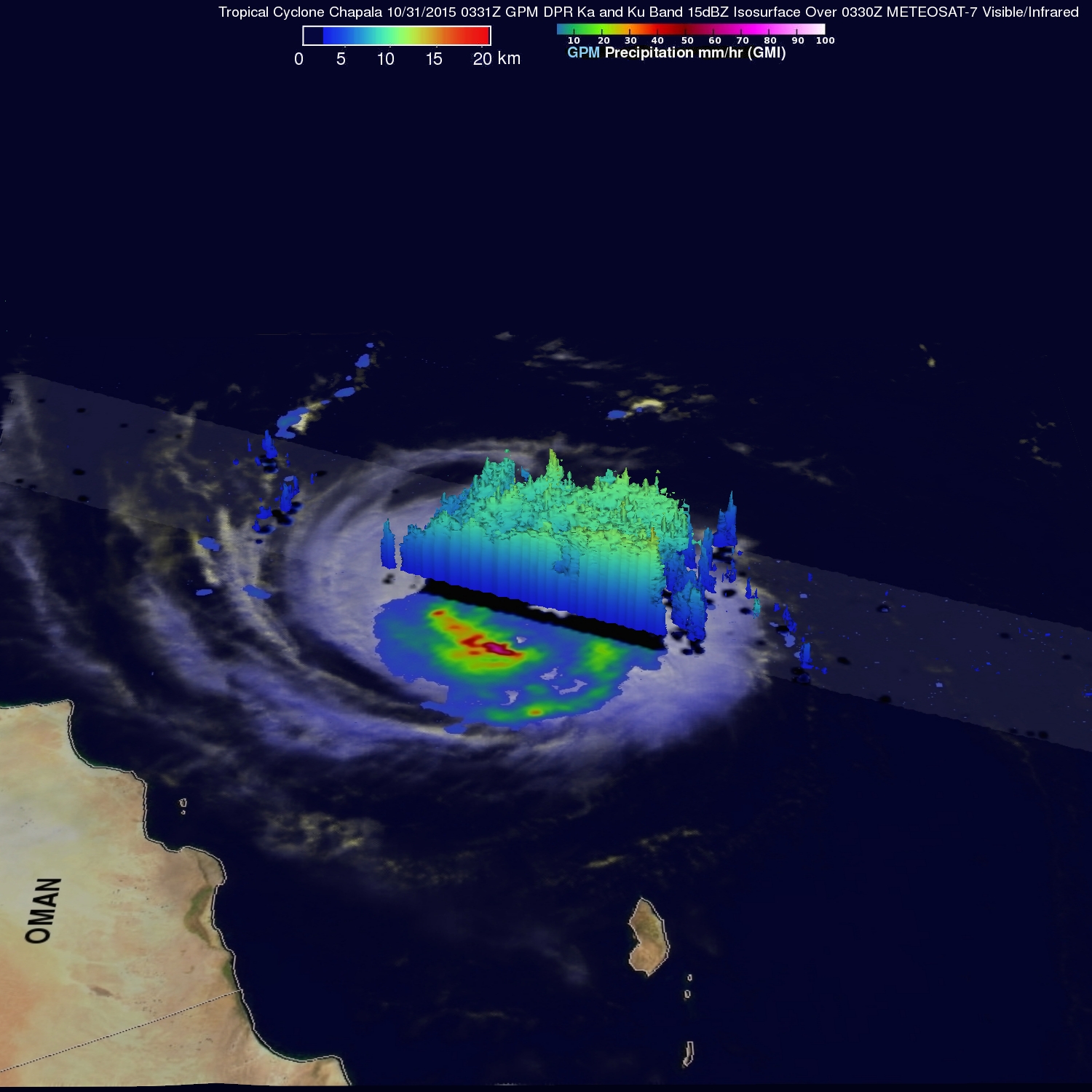
GPM's Dual-Frequency Precipitation Radar (DPR) swath of coverage, shown in a lighter shade, passed to the east of Chapala's eye. Feeder bands on that side of the tropical cyclone were found by DPR to be dropping rain at a rate of 44 mm (1.7 inches) per hour. This 3-D view toward the east was derived from GPM's Ka and Ku band radar data. It shows that storm tops on Chapala's eastern side were reaching heights of over 13.4 km (8.3 miles).
The Joint Typhoon Warning Center (JTWC) predicts that tropical cyclone Chapala will weaken but have winds of about 75 kts (86 mph) as it enters the Gulf Of Aden tomorrow.