
GPM Sees Hurricane Celia Twice
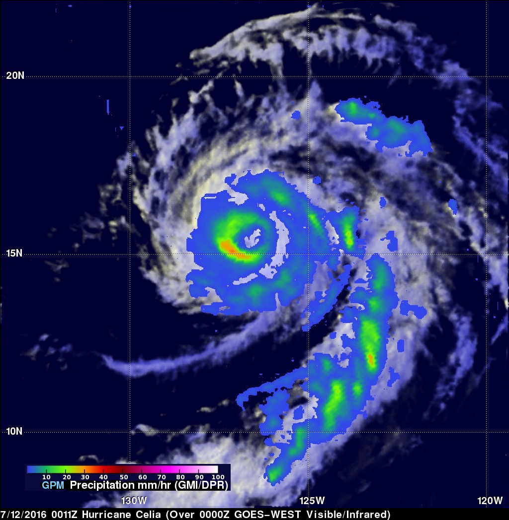
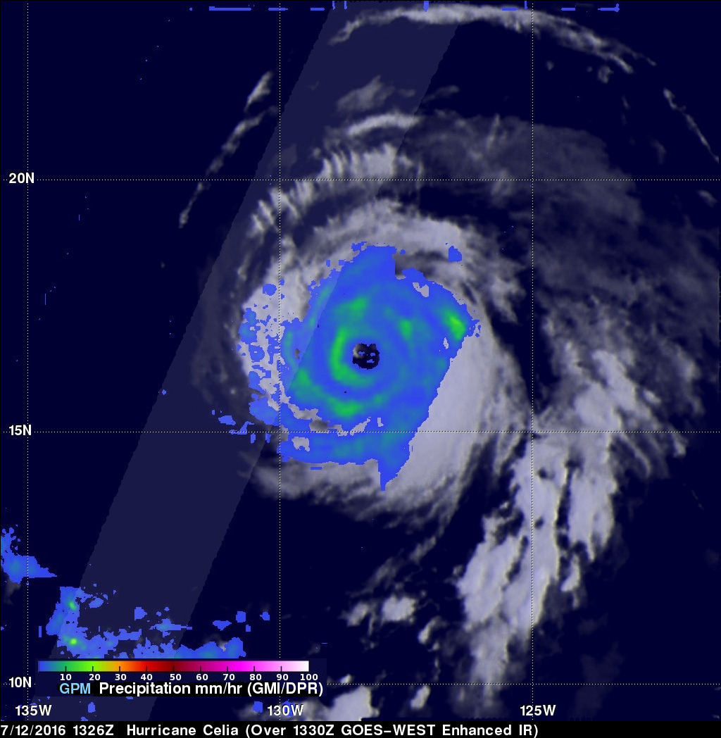
The GPM core observatory satellite twice flew almost directly above hurricane Celia in the eastern Pacific Ocean on July 12, 2016. The first time was on July 12, 2016 at 0011 UTC and the second view was on July 12, 2016 at 1326 UTC. With both passes GPM's Microwave Imager (GMI) clearly showed the location of rainfall around hurricane Celia's well defined eye. The hurricane had maintained intensity during this period with sustained maximum wind speeds estimated at 80 kts (92.8 mph). With the first pass GMI measured rain in the southwestern side of Celia's eye wall falling at a rate of close to 33 mm (1.3 inches) per hour.
GPM rainfall estimates are shown overlaid on GOES-WEST satellite images at close to the same time.
Hurricane Celia is moving in the general direction of the Hawaiian Islands but is predicted to weaken to tropical depression intensity in a few days as it moves into the central Pacific.
GPM is a joint mission between NASA and the Japanese space agency JAXA.