
GPM Sees Jelawat Becoming A Typhoon
Tropical storm JELAWAT intensified as expected and was upgraded to typhoon JELAWAT yesterday. Today JELAWAT has continued to rapidly intensify and maximum sustained wind speeds in the typhoon were estimated at 115 kts (132 mph).
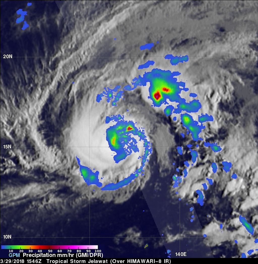
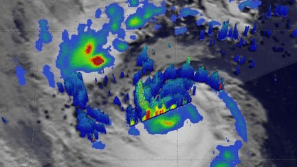
The GPM core observatory satellite had an excellent view of rapidly intensifying tropical storm JELAWAT on March 29, 2018 at 1546 UTC. JELAWAT had wind speeds of about 60 kts (69 mph) when GPM passed over head. An eye hadn't formed yet but rain bands were wrapping around JELAWAT's well established center of circulation. GPM's radar (DPR Ku Band) revealed that rain was dropping at a rate of greater than 122 mm (4.8 inches) per hour in convective storms northeast of JELAWAT's center.
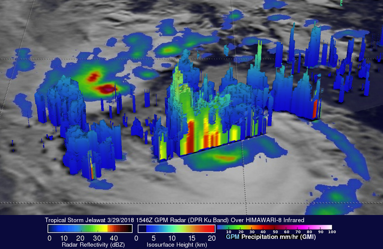
3-D views of tropical storm JELAWAT's precipitation were constructed using GPM's Dual Frequency Precipitation Radar (DPR). Vertical slices through GPM's radar data (DPR Ku Band) showed that convective storms in the northeastern quadrant of the tropical storm were reaching heights above 13.0 km (8.1 miles).
The Joint Typhoon Warning Center (JTWC) predicts that typhoon JELAWAT will reach it's maximum intensity today. JELAWAT is predicted to have maximum sustained winds of about 120 kts (138 mph) at peak power. JELAWAT is expected to encounter increased vertical wind shear as it moves toward the northeast then east. Wind speeds in the tropical cyclone are expected to drop to 35 kts (40 mph) in the next five days.