
GPM Sees Ockhi's Rain Reaching India's Western Coast
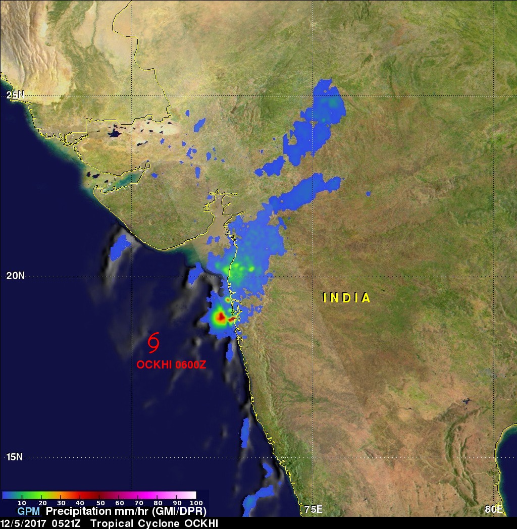
NASA's GPM Core Observatory satellite passed over western India on December 5, 2017 at 0521 UTC. GPM's Microwave Imager (GMI) and Dual-Frequency Precipitation Radar (DPR) instruments showed precipitation from dissipating tropical cyclone OCKHI reaching India's western coast. GPM's radar (DPR Ku band) indicated that rain was falling at a rate of over 101.6 mm (4 inches) per hour in a few storms near India's coast. OCKHI's low level center of circulation, shown with a red tropical cyclone symbol, was located well to the southwest of the storms that were moving onto India's western coast.
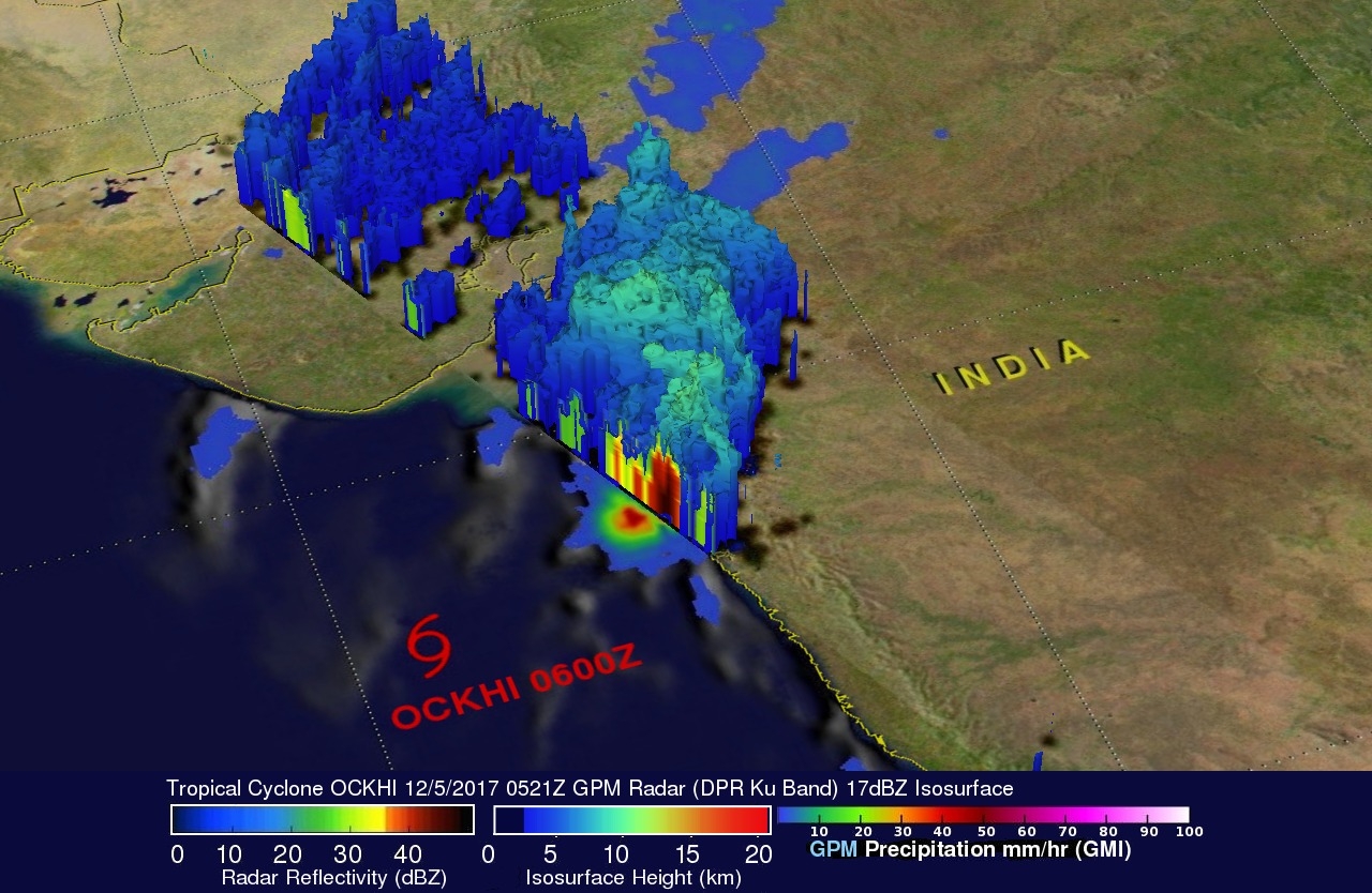
This 3-D view of tropical cyclone OCKHI was constructed using GPM's radar (DPR Ku Band) data. A 3-D radar slice through a few heavy storms near India's western coast showed that intense showers in that area were returning strong radar reflectivity values. Storm top heights in the most powerful of these storms were found by DPR to reach altitudes of about 10 km (6.2 miles).
A few hours after this GPM pass the Joint Typhoon Warning Center (JTWC) issued it's final warning on the dissipating tropical cyclone.