
GPM Sees Patricia Becoming A Hurricane
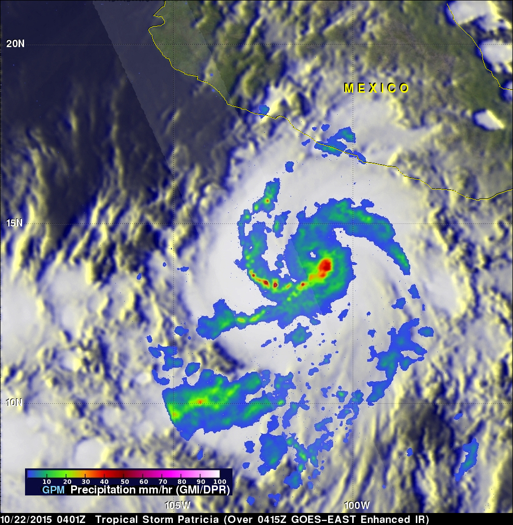
During the night tropical storm Patricia became much better organized and was upgraded to a hurricane. The GPM core observatory satellite flew above the intensifying tropical cyclone on October 22, 2015 at 0401 UTC. Patricia was still a tropical storm with maximum sustained winds estimated at 55 kts (63 mph) at that time but rainfall derived from GPM's Microwave Imager (GMI) and Dual-Frequency Precipitation Radar (DPR) instruments showed that an eye was forming. The National Hurricane Center (NHC) 0400 AM CTD discussion said that, "... 37 GHz GPM image showed a cyan ring around the eye, which often presages rapid intensification". GPM's GMI found intense rainfall just to the southeast of the forming eye. GPM's DPR measured rain falling at the extreme rate of almost 110 mm (4.3 inches) within an intense feeder band west of Patrica's center.
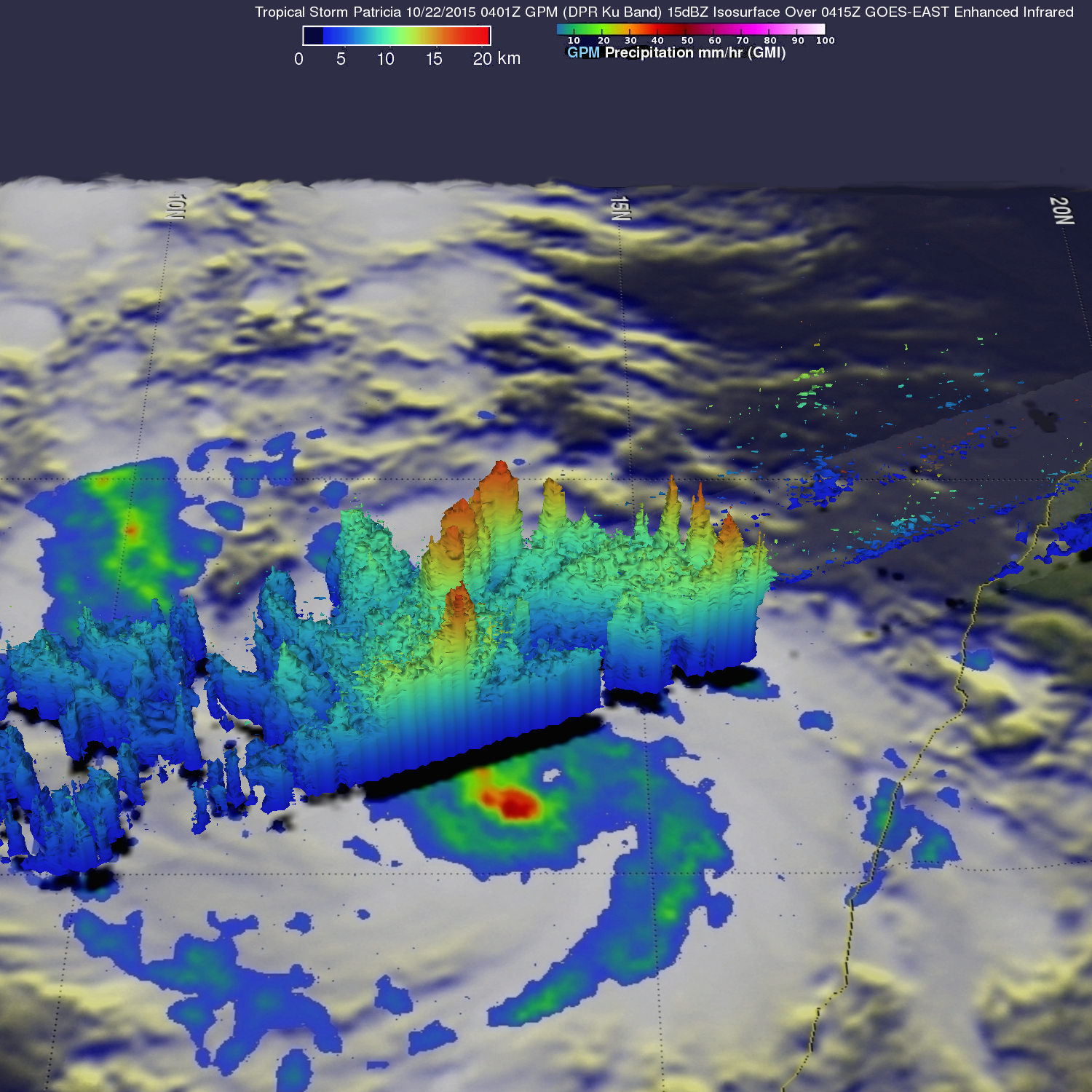
A simulated 3-D view (looking toward the west) was constructed using GPM radar (Ku Band). This view showed storm top heights reaching extreme heights of over 18.5 km (11.5 miles) in the strong convective storms in the feeder band to the west of Patricia's forming eye.
Environmental conditions remain favorable for future intensification of hurricane Patricia. The National Hurricane Center (NHC) forecasts that Patricia's winds will increase to 110 kts (127 mph) tomorrow.