GPM Sees Possible Tropical Cyclone Forming In The Bay Of Bengal
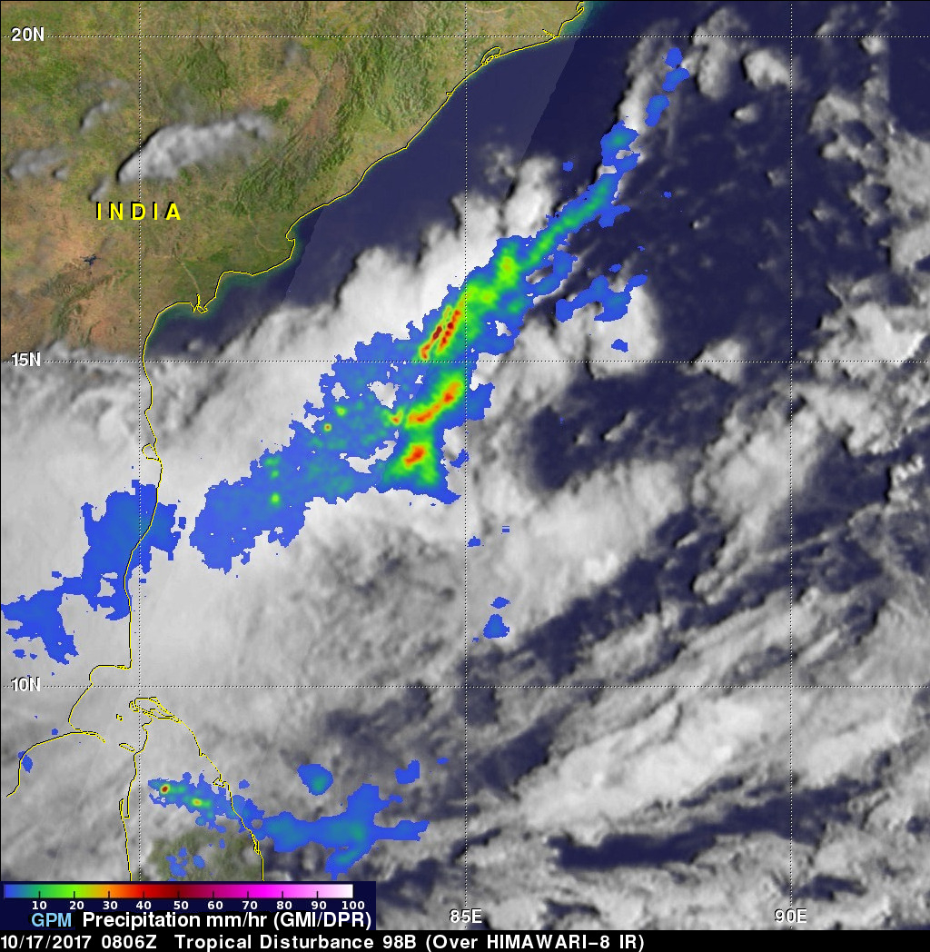
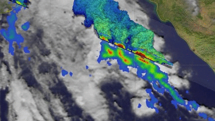
On October 17, 2017 at 0806 UTC the GPM core observatory satellite passed above a low pressure center in the western Bay Of Bengal where a tropical cyclone is probably forming. Warm sea surface temperatures in the Bay Of Bengal are supplying the necessary energy but moderate vertical wind shear observed to the south of the low are counteracting tropical cyclone development. Rainfall rates within the potential tropical cyclone were estimated using data collected by GPM's Microwave Imager (GMI) and Dual-Frequency Precipitation Radar (DPR) instruments. Extremely heavy rainfall accompanied strong convective showers in an intense line of precipitation off India's coast. GPM's radar (DPR Ku Band) found rain falling at a rate of greater than 5 inches (128 mm) per hour in this line of storms.
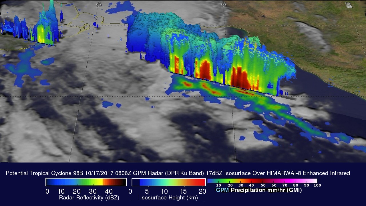
GPM's 3-D Radar data (DPR Ku Band) were used to show the rainfall structure within the tropical disturbance. GPM's DPR found storm tops reaching heights above 16 km (9.92 miles) in one strong band of convective storms.