
GPM Sees Powerful Thunderstorms In Landfalling Hurricane Nate
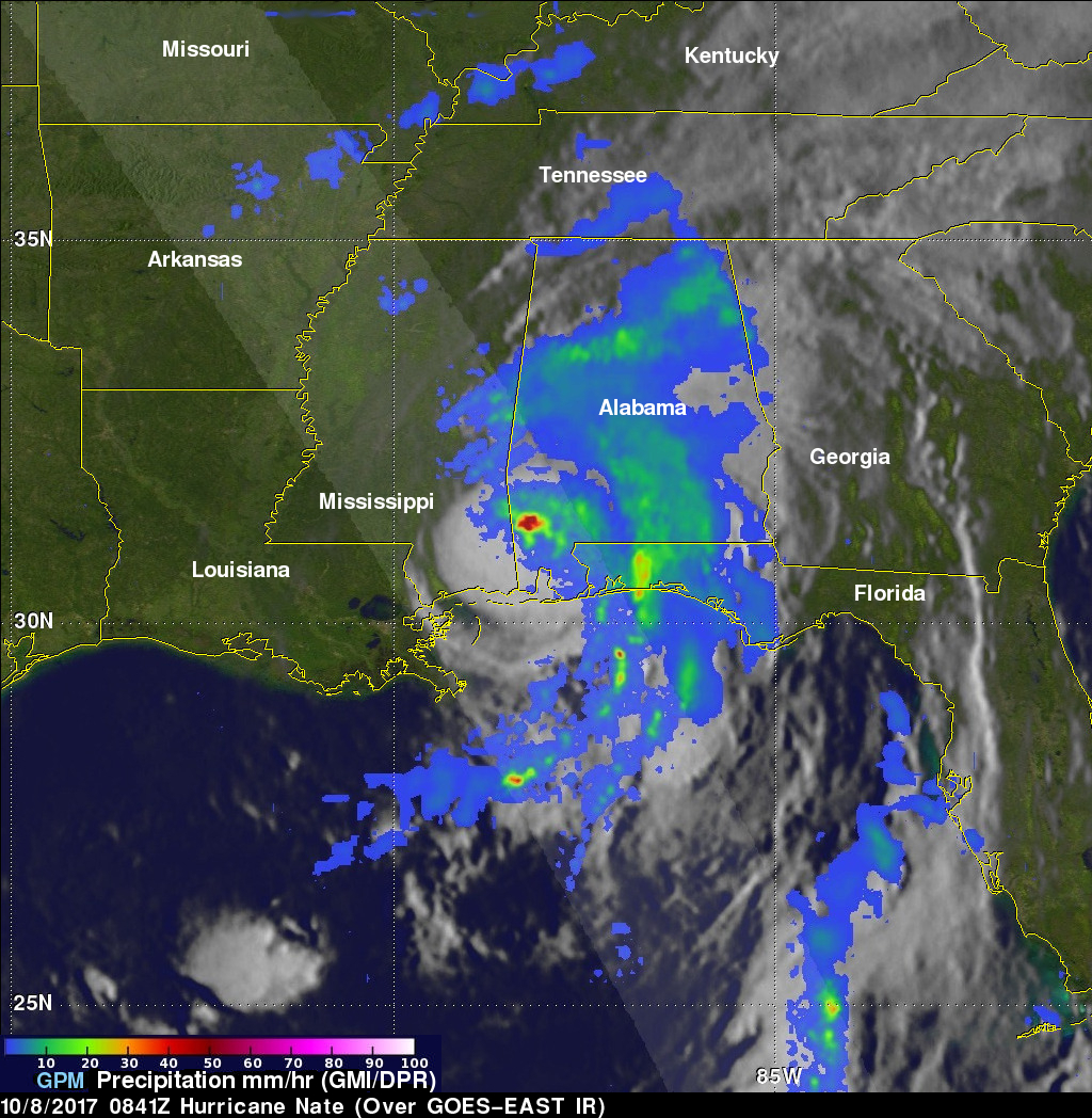
The GPM core observatory satellite passed above powerful thunderstorms within land falling hurricane Nate on October 8, 2017 at 4:41 AM EDT (0841 UTC). GPM's Dual-Frequency Precipitation Radar (DPR) found that a few storms over southwestern Alabama were dropping rain at the extreme rate of greater than 4 inches (102 mm) per hour.
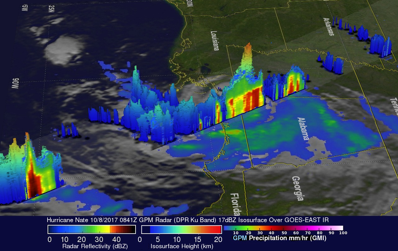
This 3-D slice by GPM's radar (DPR Ku Band) shows the structure of precipitation within the powerful thunderstorms near the center of hurricane Nate. A few thunderstorms over Alabama were found by GPM's radar to have tops reaching heights above 10.5 miles (17 km).
Images and caption by Hal Pierce (SSAI/NASA GSFC)