
GPM Sees Towering Thunderstorms In Intensifying Tropical Storm Earl
Tropical storm Earl has been intensifying as it moves through the Caribbean Sea. The National Hurricane Center (NHC) now predicts that Earl will be a hurricane before it hits Mexico's Yucatan Peninsula tomorrow afternoon. Earl is predicted by NHC to remain in a light to moderate vertical wind shear environment over very warm sea surface temperatures until landfall.
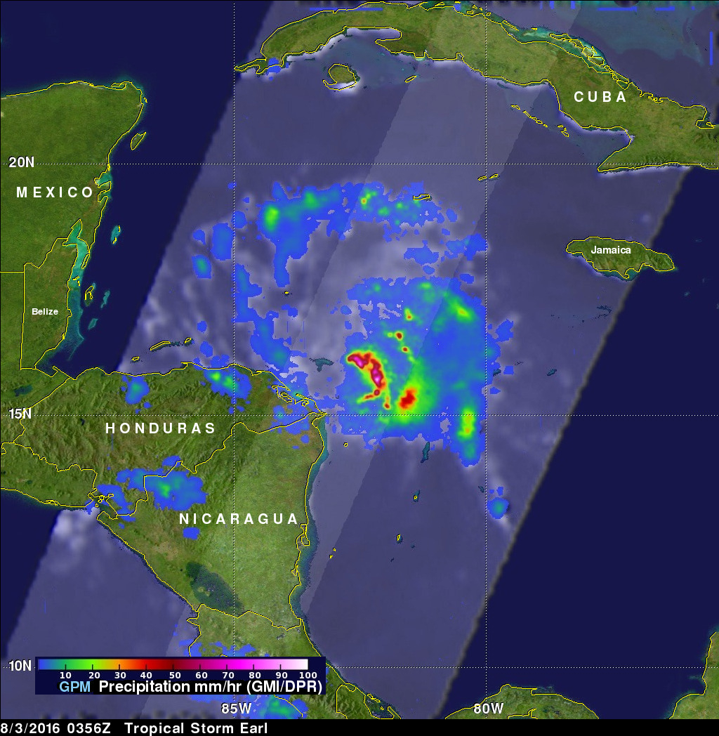
The GPM core observatory satellite passed over intensifying tropical storm Earl in the Caribbean Sea northeast of Honduras on August 3, 2016 at 0356 UTC ( August 2, 2016 11:56 PM EDT). GPM's Microwave Imager (GMI) and Dual-Frequency Precipitation Radar (DPR) showed that powerful storms around Earl's forming eye were dropping extremely heavy rainfall. DPR found that Rain was falling at a rate of over 251 mm (9.8 inches) per hour in a band of powerful convective storms.

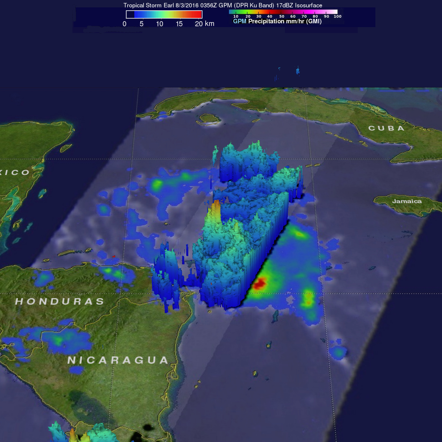
GPM's Radar (DPR Ku band) were used to show in 3-D the towering thunderstorms near Earl's center reaching heights of over 16 km (9.9 miles). These strong thunderstorms called "hot towers" often lead to rapid intensification in a tropical cyclone.