GPM Sees Tropical Cyclone Eliakim Forming, Threatening Madagascar
The Joint Typhoon Warning Center (JTWC) issued it's first warning for tropical cyclone ELIAKIM on March 15, 2018 at 0300 UTC as the tropical cyclone moved closer to the northeastern tip of Madagascar. It's maximum sustained wind speeds had increased to 50 kts (57.5 mph) by March 15, 1200 UTC.
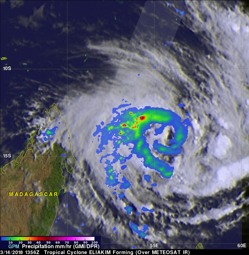
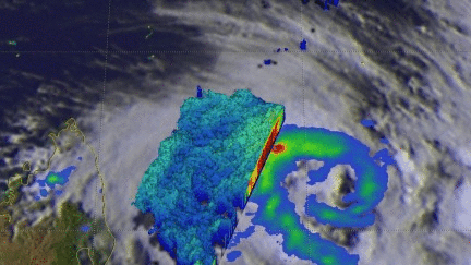
Forming tropical cyclone ELIAKIM was shown with improved organization when the GPM core observatory satellite flew above on March 14, 2018 at 1356 UTC. GPM's Dual Frequency Precipitation Radar (DPR) data revealed that intense convective storms were occurring in the northwest quadrant of the forming tropical cyclone. 3-D probing by GPM's radar revealed the potency of storms in that part of the forming tropical cyclone. GPM's DPR found that a few storms in that area were dropping rain at a rate of over 205 mm (8.1 inches) per hour.
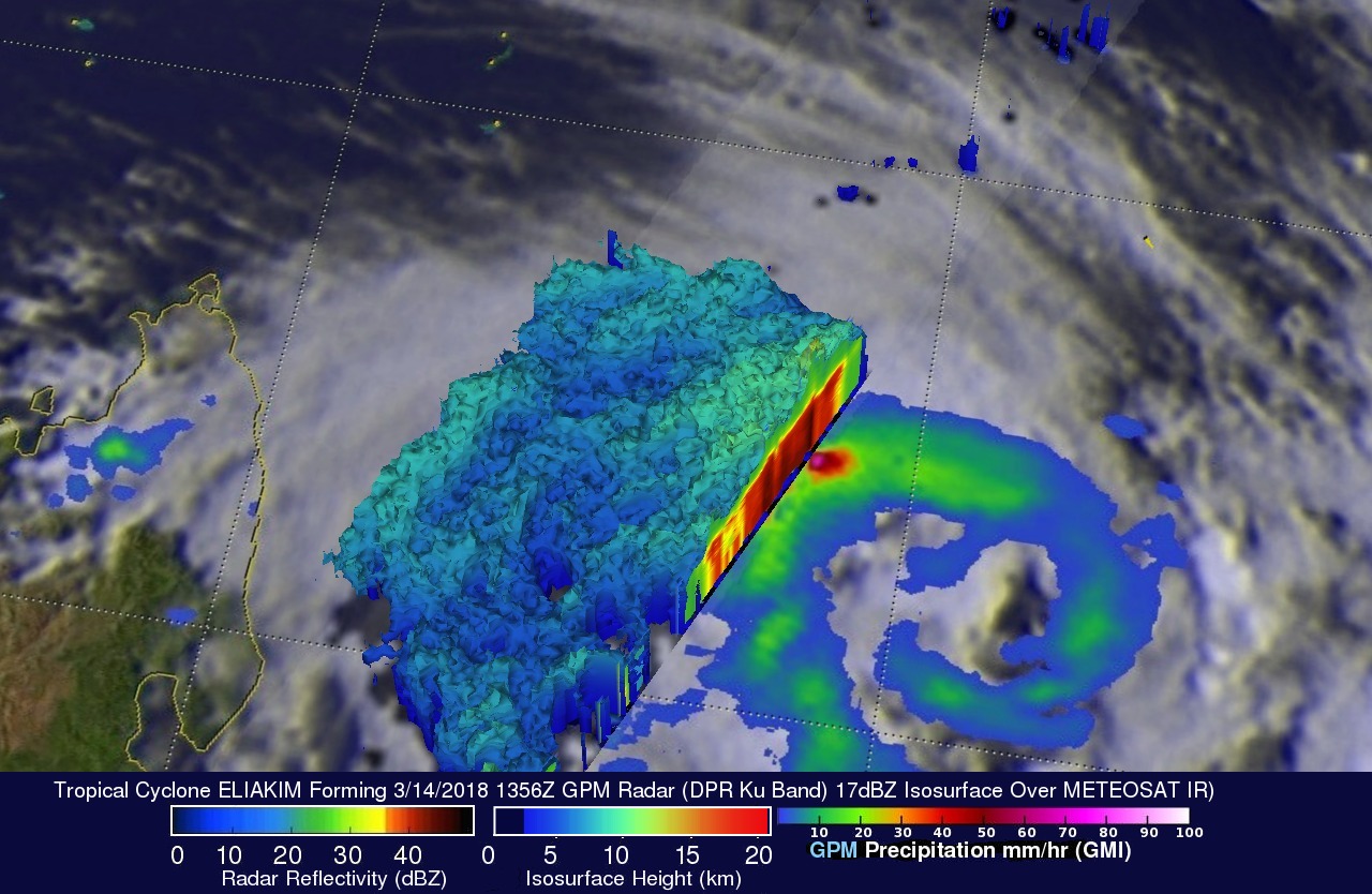
This simulated 3-D view used GPM radar data (DPR ku Band) to show the intensity and heights of powerful convective storms on the northwestern side of the developing tropical cyclone. Storm top heights above 13 km (8.1 miles) were frequently spotted in that region by GPM's radar.
Tropical cyclone ELIAKIM is expected to intensify and have strong tropical storm force winds when it hits northeastern Madagascar tomorrow. Rough terrain over Madagascar is predicted to cause ELIAKIM to weaken before the tropical cyclone moves back over the Indian Ocean in a few days.