GPM Sees Tropical Cyclone Fakir Forming Near Madagascar
The southwest Indian Ocean cyclone season started on November 15, 2017 and will officially end on April 30, 2018. A tropical cyclone labeled FAKIR by Meteo France formed today near northeastern Madagascar. FAKIR is expected to intensify as it moves toward the southeast and could be a significant tropical cyclone tomorrow. This cyclone season has already seen Madagascar battered and drenched by tropical cyclones Ava, Dumazile, and Eliakim.
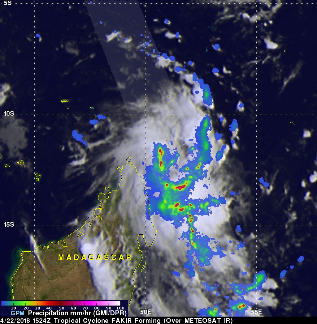
The GPM core observatory satellite flew above the forming late season tropical cyclone near northeastern Madagascar on April 22, 2018. The satellite's Microwave Imager (GMI) and Dual Frequency Precipitation Radar (DPR) instruments revealed the locations of heavy rainfall associated with the forming tropical cyclone. GPM showed that bands of extremely heavy rainfall were spiraling into the tropical low's southeastern side. GPM's radar (DPR Ku Band) showed that precipitation was falling at a rate of over 219 mm (8.6 inches) per hour in some of the strong convective storms that were moving toward Madagascar.
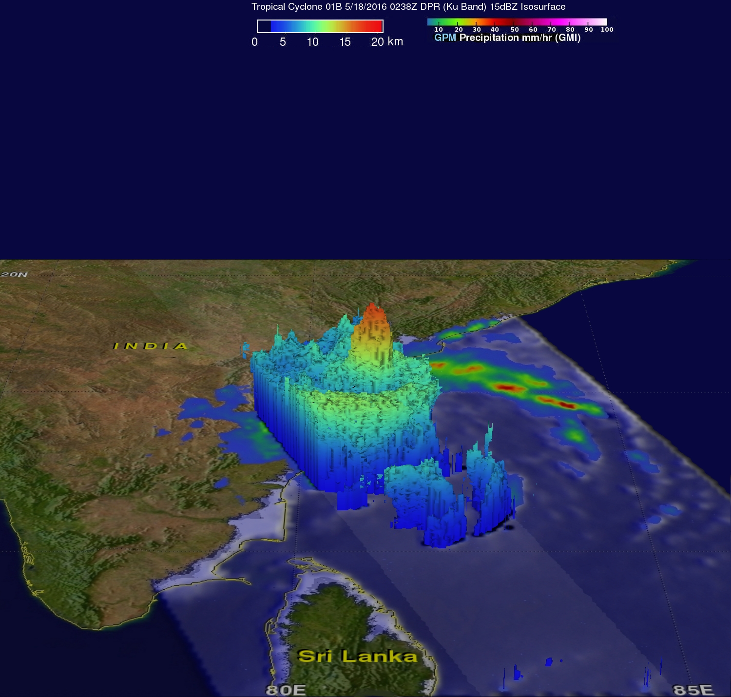
This 3-D view of precipitation in forming tropical cyclone FAKIR was developed with GPM's radar (DPR Ku Band). This computer simulated 3-D cross section used GPM's radar probes to show the heights of cloud tops and radar reflectivity values within the forming tropical cyclone. GPM's radar indicated that a few of the tallest intense convective storms were reaching heights of almost 16 km (9.9 miles).