GPM Sees Tropical Cyclone Forming
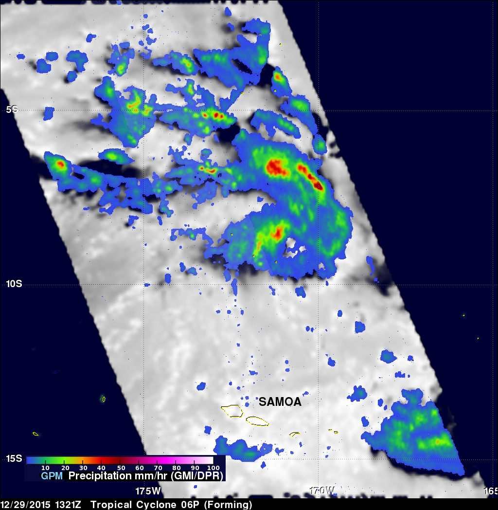
The GPM core observatory satellite passed above tropical cyclone 06P when it was forming in the south Pacific Ocean north of Samoa on December 29, 2015 at 1321 UTC. A rainfall analysis was performed using data collected at that time by GPM's Microwave Imager (GMI) and Dual-Frequency Precipitation Radar (DPR) instruments. Data from GMI were used to calculate that rain was falling at a rate of over 83.6 mm (3.29 inches) per in a feeder band northeast of the low's center.
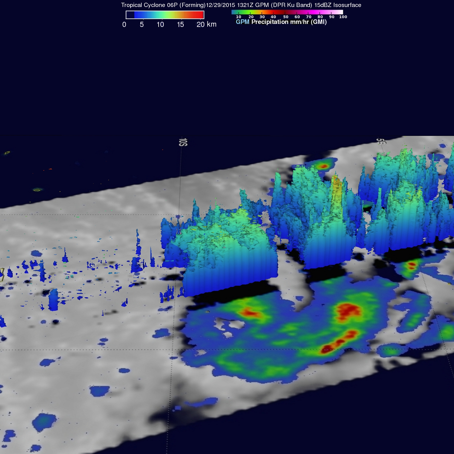
Radar data from GPM's DPR Ku band radar were used to show the 3-D structure of precipitation within the forming tropical cyclone. Some storm top heights in this radar cross section were found to reach heights of over 15 km (9.3 miles). 06P has reached tropical storm intensity today and the Joint Typhoon Warning Center (JTWC) predicts that the tropical cyclone will become more powerful as it re-curves toward the southwest. On December 1, 2015 06P is expected to have hurricane force winds of 75 kts (86 mph).


