GPM Sees Tropical Cyclone Maarutha Develop
Tropical Storm Maarutha became the first tropical cyclone of 2017 in the Bay of Bengal when it formed on April 15, 2017. Maarutha intensified slightly as it moved northeastward toward Burma (Myanmar). Maarutha reached it's maximum sustained wind speed of 45 kts (52 mph) over the open waters of the Bay Of Bengal.
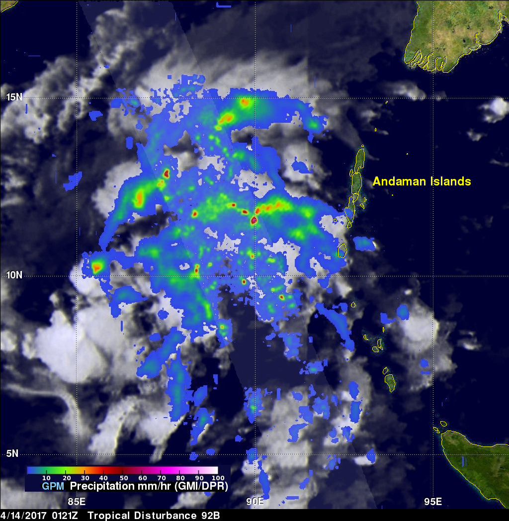

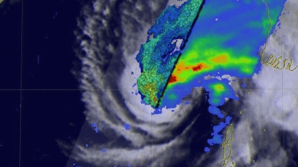
The GPM core observatory satellite had a good view of the forming tropical cyclone on April 14, 2017 at 0121 UTC when it was in the Bay Of Bengal west of the Andaman Islands. GPM had another excellent view just before the organizing tropical cyclone was designated tropical storm Maarutha on April 15, 2017 at 1431 UTC. The GPM satellite's Microwave Imager (GMI) and Dual-Frequency Precipitation Radar (DPR) instruments showed bands of intense rain wrapping into the low level circulation. GPM's DPR showed that rain was falling at a rate of over 134 mm (5.3 inches) per hour in convective storms near the tropical cyclone's center of circulation.
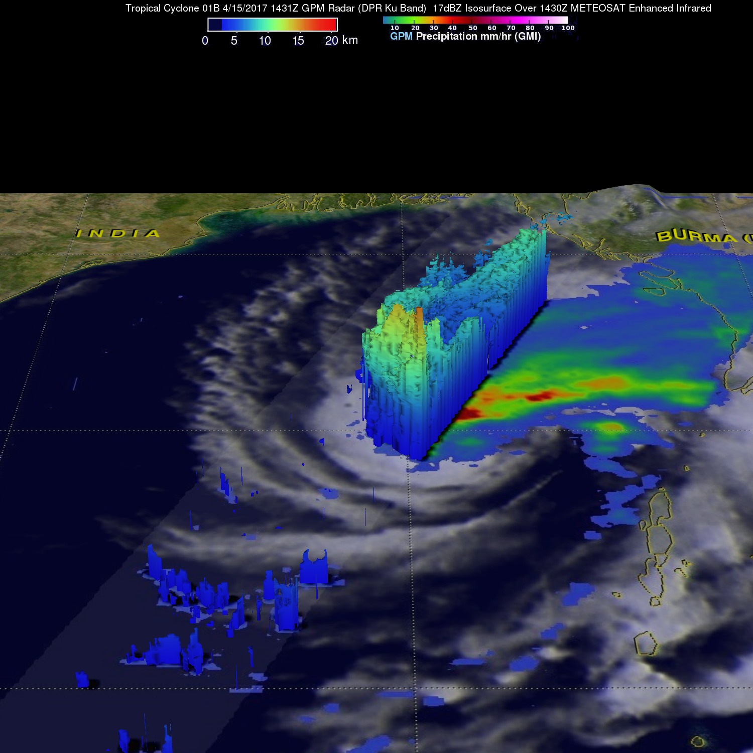
GPM's radar (DPR Ku Band) data were used to reveal a 3-D vertical cross section through the tall convective storms near the tropical cyclone's center. This examination showed that these powerful convective towers had storm tops that were reaching altitudes higher than 17.6 km (10.9 miles).
Maarutha weakened rapidly after it came ashore and interacted with Burma's rugged terrain. The Joint Typhoon Warning Center (JTWC) issued it's last warning for the rapidly dissipating tropical cyclone on April 16, 2017 at 2100 UTC.