
GPM Sees Tropical Depression SIX-E Forming
A large area of low pressure in the eastern Pacific Ocean was sufficiently organized and developed that the National Hurricane Center (NHC) designated it as tropical depression SIX-E on July 15, 2016 at 1500Z (9:00 AM MDT). With the development of tropical depression SIX-E there are currently three active tropical systems in the eastern Pacific Ocean.
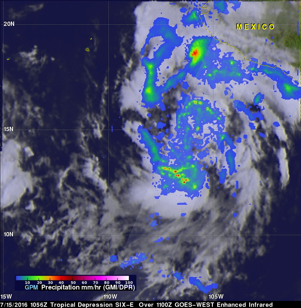
The GPM core observatory had a good view of forming tropical depression SIX-E when it flew over on July 15, 2016 at 1056 UTC (4:56 AM MDT). Precipitation data were calculated from data collected by GPM's Microwave Imager (GMI) and Dual-Frequency Precipitation Radar (DPR) instruments. DPR data indicated that a few tall convective storms in the area were dropping rain at a rate of over 171 mm (6.7 inches) per hour.
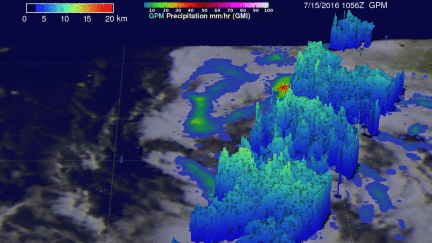
GPM radar (DPR Ku Band) 3-D measurements of the developing tropical depression showed that the most intense rain showers were located in a cluster of convective storms south of the center of the developing circulation. An animation was developed that shows the locations where intense showers were returning the strongest echoes (> 40 dBZ) to the GPM satellite. DPR showed that storm top heights were reaching altitudes of almost 15 km (9.3 miles) in that area.
The National Hurricane Center (NHC) predicts that SIX-E will intensify while moving toward the west-northwest and become a hurricane over the open waters of the eastern Pacific Ocean in a couple days.