
GPM Sees Tropical Storm Earl Forming
Today a tropical wave in the Caribbean Sea south of Cuba developed a closed circulation center and was then designated tropical storm Earl by the National Hurricane Center (NHC). Earl is the fifth tropical cyclone to form in the Atlantic Ocean this year.
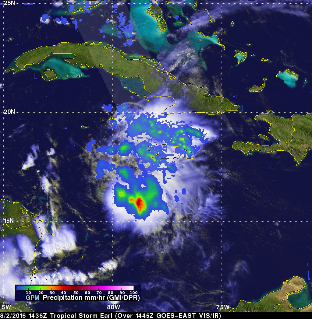
The GPM core observatory satellite flew over the forming tropical storm on August 2, 2016 at 1436 UTC (10:36 AM EDT). GPM's Microwave Imager (GPM) and Dual-Frequency Precipitation Radar (DPR) data were used in this analysis to show precipitation accompanying Earl. GPM's GMI provided excellent coverage of heavy convective rainfall in the Caribbean Sea south of Jamaica. GPM's DPR data swath examined convective storms northeast of Earl's center of circulation. DPR measured precipitation in some of these storms falling at a rate of over 118 mm (4.6 inches) per hour.
GPM's Radar (DPR Ku Band) showed the 3-D structure of rainfall in the storms around Jamaica. Storm top heights in some energetic convective storms were found to reach heights of over 15 km (9.3 miles).
A NHC forecast predicts that Earl will be a strong tropical storm when it hits Mexico's Yucatan Peninsula in a couple days. Earl is expected to weaken slightly over land and then re-emerge into the southwestern Gulf Of Mexico.