
GPM Sees Tropical Storm Koppu Menacing The Philippines
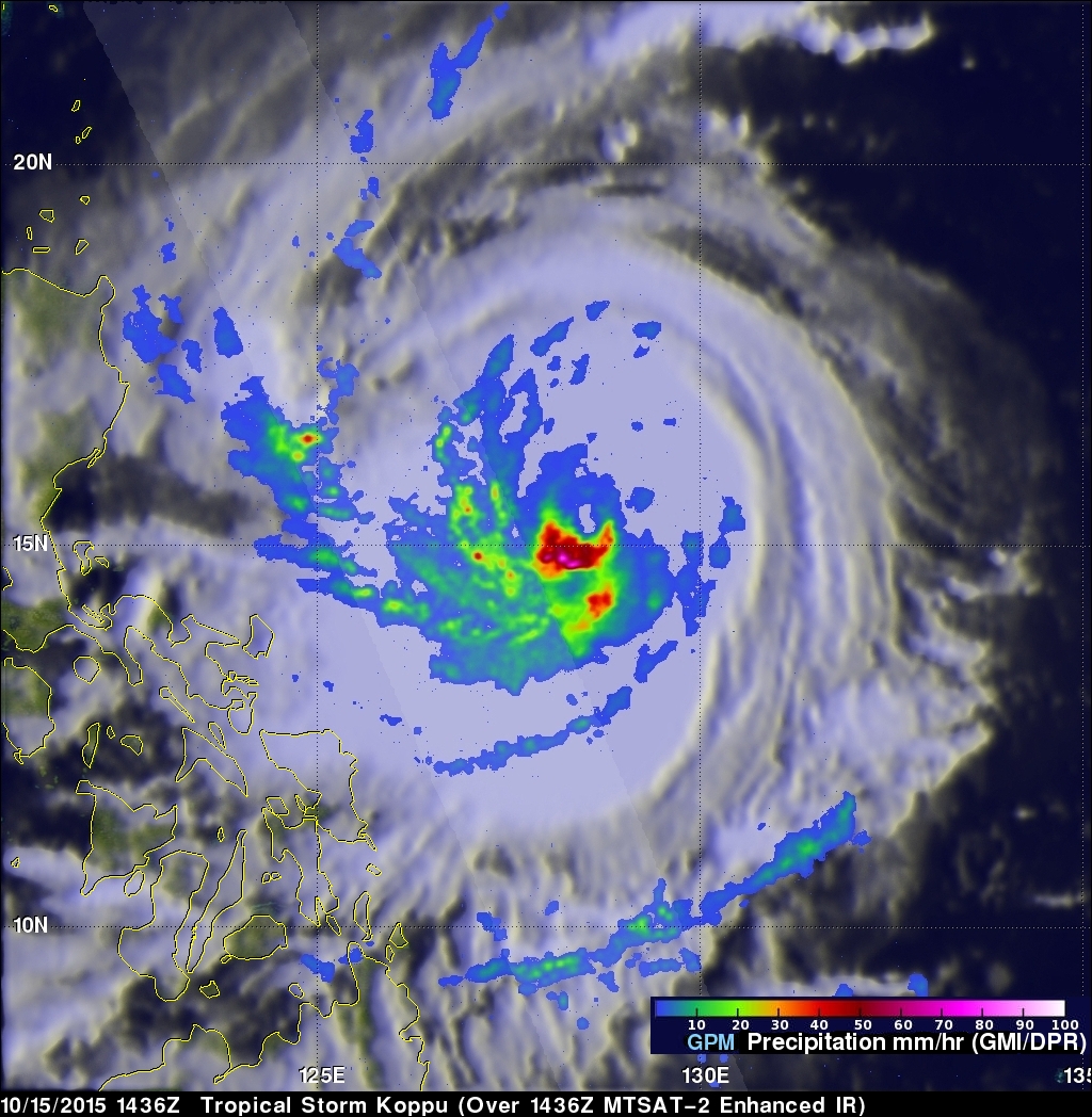
Tropical storm Koppu was approaching the Philippines with sustained winds estimated of 60 kts (69 mph) when the GPM core observatory satellite passed above on October 15, 2015 at 1436 UTC. A rainfall analysis using data collected by GPM's Microwave Imager (GMI) instrument revealed that an eye was very close to forming near Koppu's center of circulation. Rain was measured by GPM's GMI instrument dropping rain at a rate of over 133 mm (5.3 inches) per hour in intense convective thunderstorms just southwest of Koppu's center.
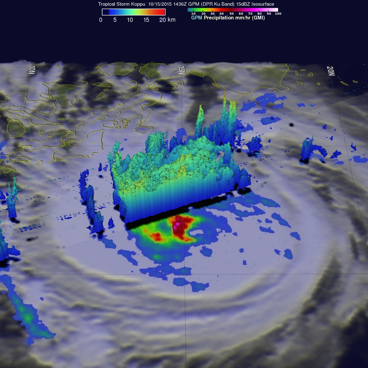
Data from GPM's Dual-Frequency Precipitation Radar (DPR) instrument were used to show the 3-D structure of convective thunderstorms on Koppu's western side. Some of these powerful storms were found by DPR to reach altitudes of over 14.5 km (amost 9 miles high).
The Joint Typhoon Warning Center (JTWC) predicts that tropical storm Koppu will continue becoming more powerful. Koppu is predicted to become a typhoon with wind speeds of 100 kts (115 mph) before hitting the Philippine island of Luzon in a couple days.