
GPM Sees Typhoon Malakas Starting To Batter Japan
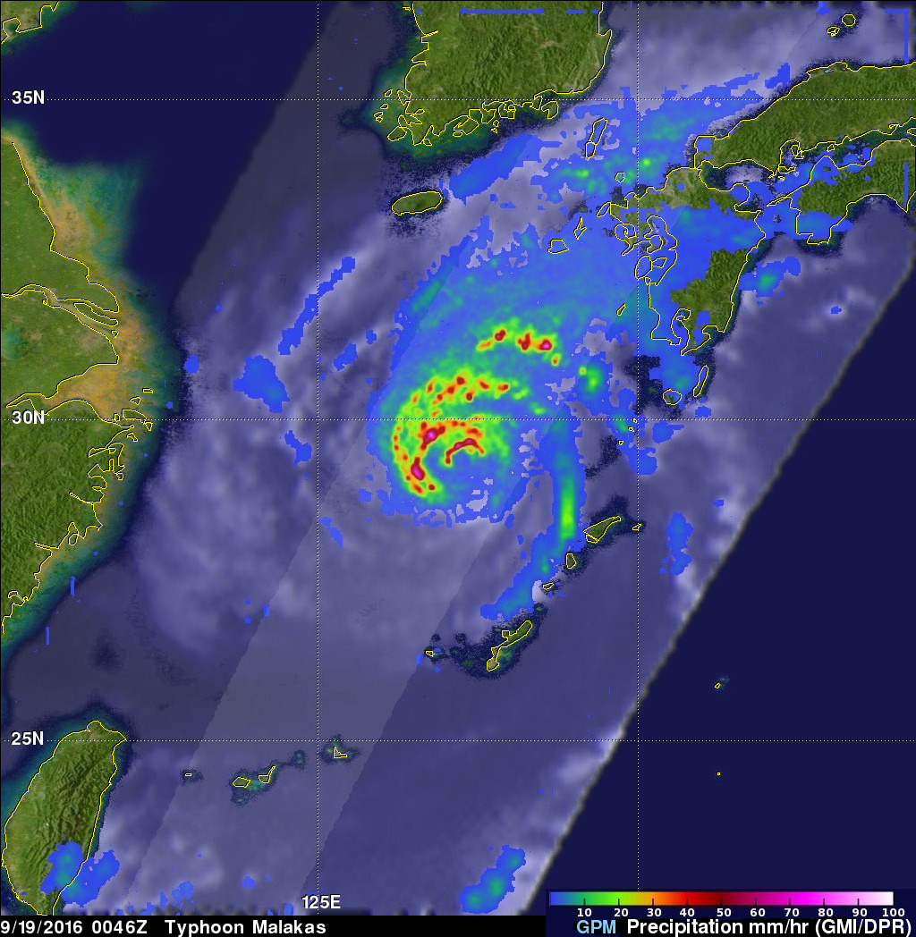
September 19, 2016 0046 UTC
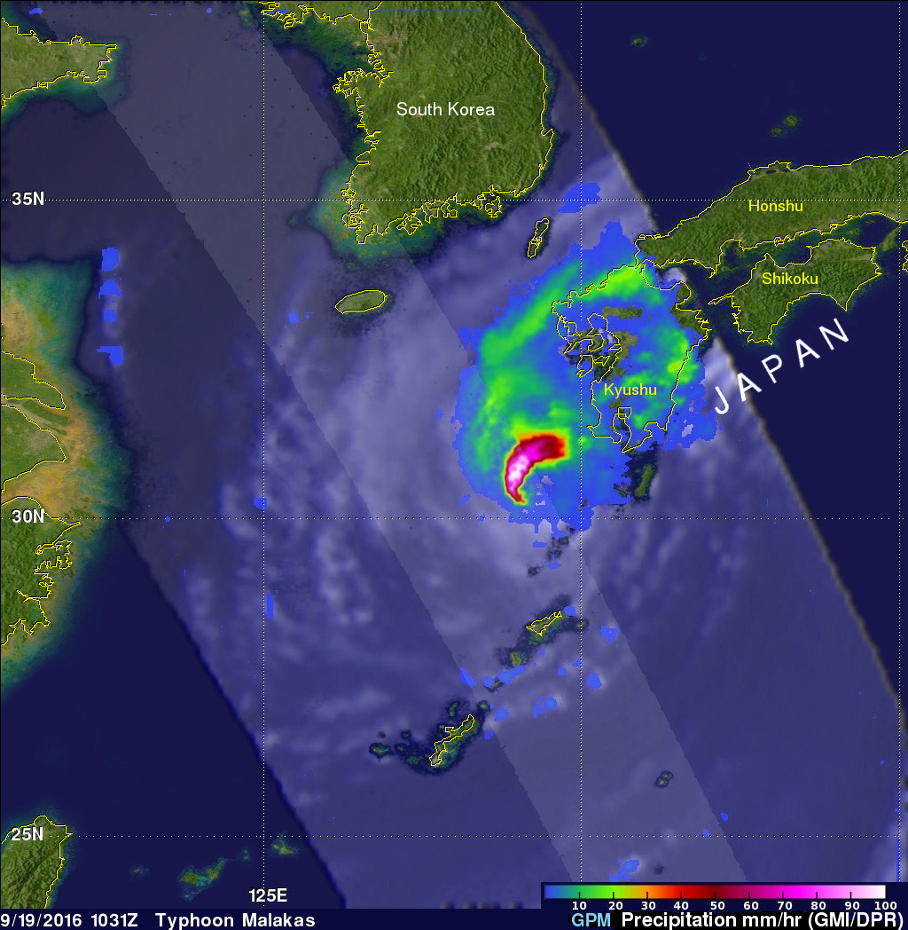
September 19, 2016 1031 UTC
After causing high winds and heavy rainfall over northern Taiwan, typhoon Malakas is now starting to batter the islands of southern Japan. The GPM core observatory satellite passed above typhoon Malakas twice on September 19, 2016. The first time was at 0046 UTC when the typhoon was starting to cause light to moderate rainfall over the island of Kyushu. At 1031 UTC GPM showed that moderate to heavy rainfall was moving over Kyushu and the typhoon's appearance had changed significantly. The change in appearance was credited to increased vertical wind shear and Malakas' interaction with the islands of Japan. With both passes GPM's Microwave Imager (GMI) and Dual-Frequency Precipitation Radar (DPR) instruments showed that Malakas contained extremely intense precipitation. GPM's radar showed that rain was falling at a rate of over 253 mm (almost 10 inches) per hour in some areas.
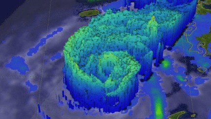
GPM's radar (DPR Ku band) found that several tall storms within the typhoon were reaching altitudes higher than 15 km (9.3 miles). DPR revealed that some very intense showers were returning radar reflectivity values of greater that 82 dBZ to the satellite.
Malakas is predicted to gradually weaken as it passes over the islands of southern Japan. Malakas' winds are expected to diminish to tropical storm intensity tomorrow. Malakas is expected to produce heavy rainfall over Japan for a couple days that may result in dangerous flooding and landslides.