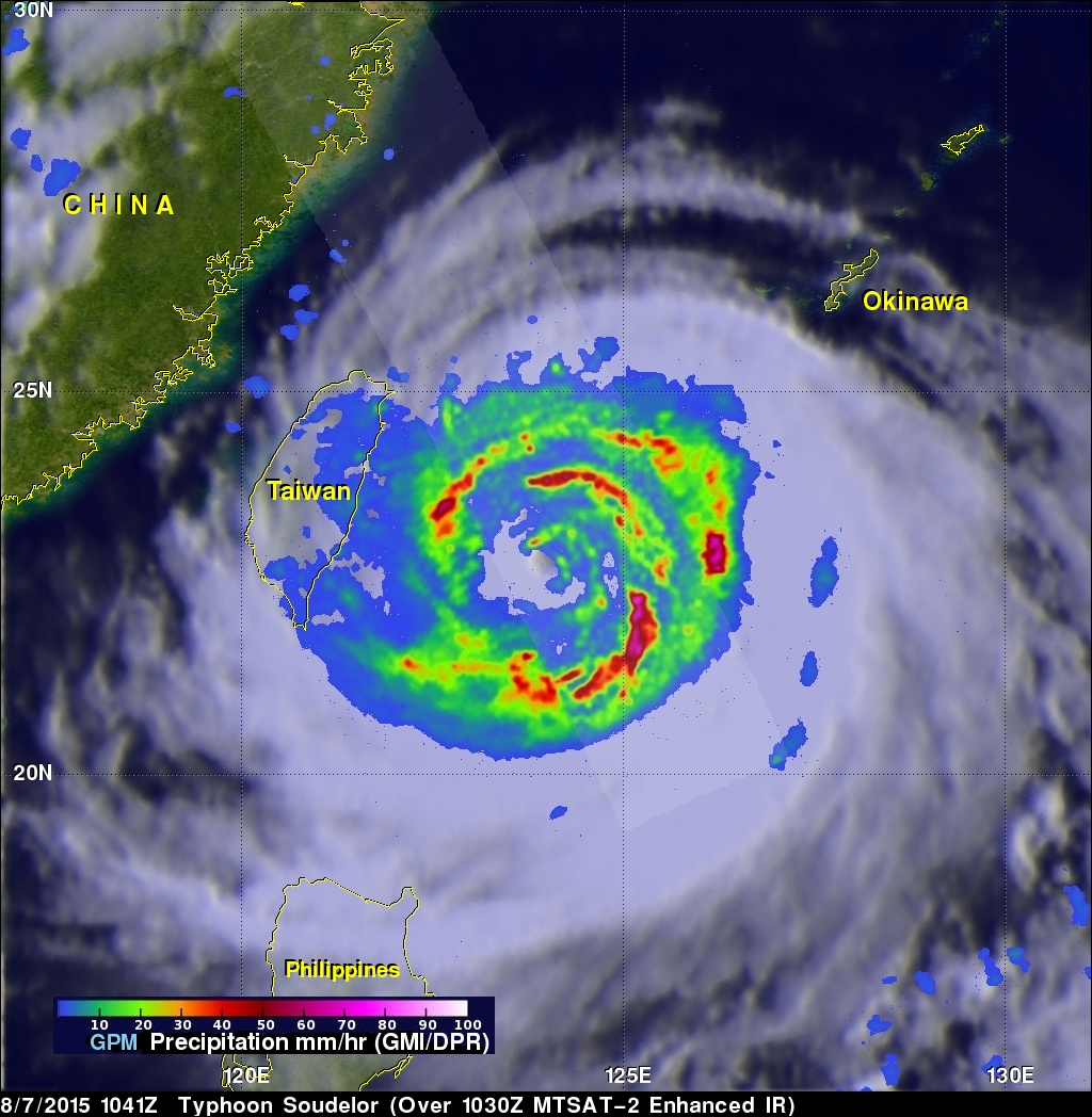
GPM Sees Typhoon Soudelor On Taiwan's Doorstep
The GPM core observatory satellite continued to provide excellent coverage of Soudelor as the typhoon closed in on Taiwan. GPM flew directly above typhoon Soudelor's eye on August 7, 2015 at 1041Z (6:41 PM Local Time) when wind speeds were 110 kts (127 mph). Rainfall data from GPM's Microwave Imager (GMI) and Dual-Frequency Precipitation Radar (DPR) instruments revealed very heavy rainfall in spiraling bands rotating around a decaying inner eye wall.
Precipitation intensity can be measured by the Dual-Frequency Precipitation Radar instrument mounted on the GPM core observatory satellite. Some rainfall was measured by GPM falling at the extreme rate of over 122 mm (4.8 inches) per hour within an intense feeder band spiraling around the southwestern side of the typhoon. 3-D reflectivity data from GPM's radar (Ku Band) also revealed typhoon Soudelor's rainfall structure. The tallest thunderstorm tops in this feeder band were found to reach heights of almost 14km (8.7 miles).
The Joint Typhoon Warning Center (JTWC) predicts that Soudelor will have winds of 115kt (132 mph) before it hits Taiwan but will have winds of 90kts (104 mph) when it passes into the Taiwan Strait.


