GPM Views Dissipating Hurricane Fernanda
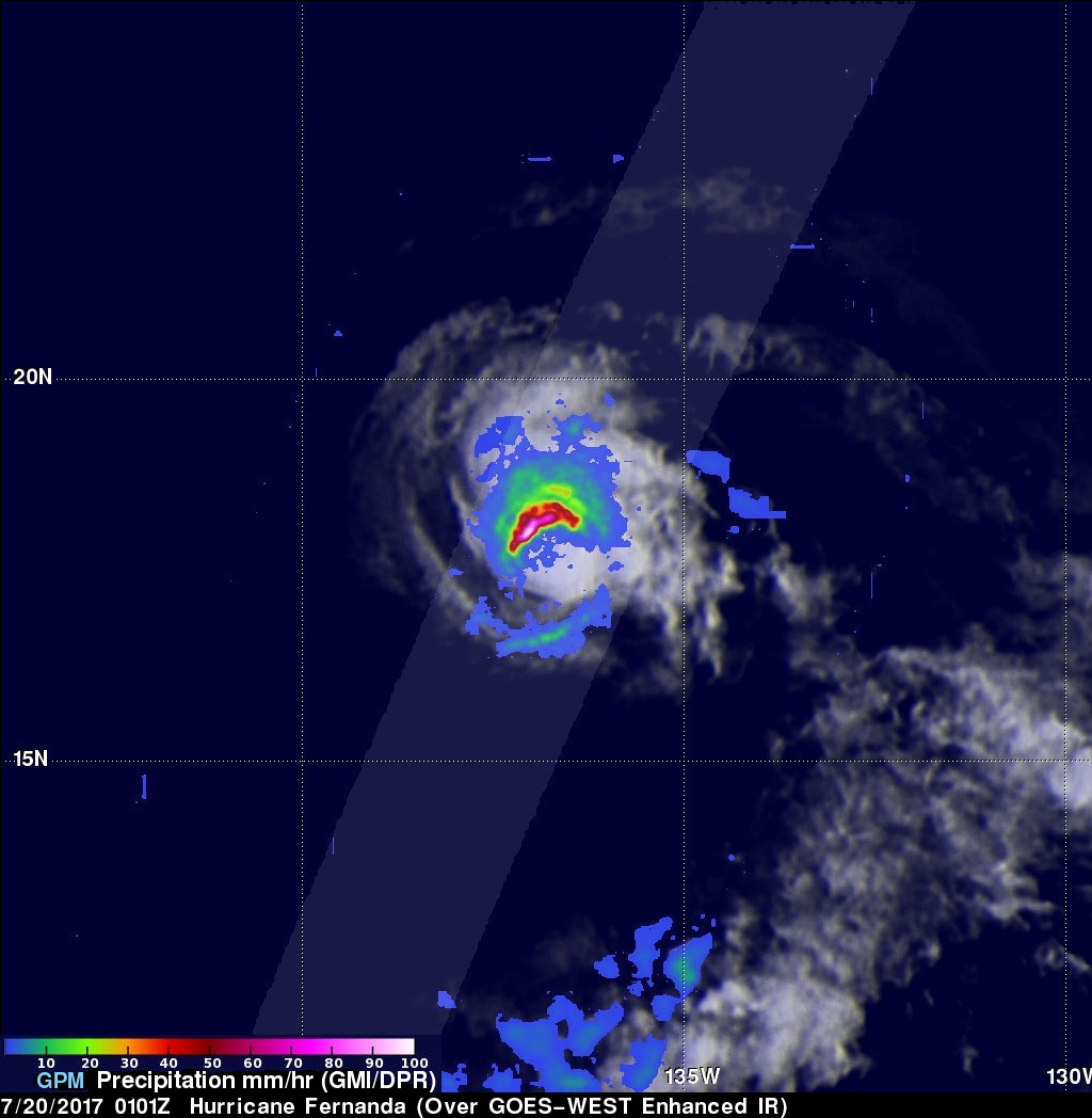
The GPM core observatory satellite had another exceptional view of hurricane Fernanda when it flew over on July 20, 2017 at 0101 UTC. GPM saw a much different hurricane than it viewed a couple days earlier. GPM's Microwave Imager (GMI) and Dual-Frequency Precipitation Radar (DPR) radar instruments found that the dissipating hurricane only contained heavy rainfall in it's northwestern quadrant. Cooler water, dry air, and southwesterly vertical wind shear had caused Fernanda to weaken. GPM's Radar revealed that powerful convective storms in that part of the dissipating hurricane were still dropping rain at a rate of almost 7.2 inches (183 mm) per hour. Very little rainfall was found by GPM in Fernanda's southeastern side.
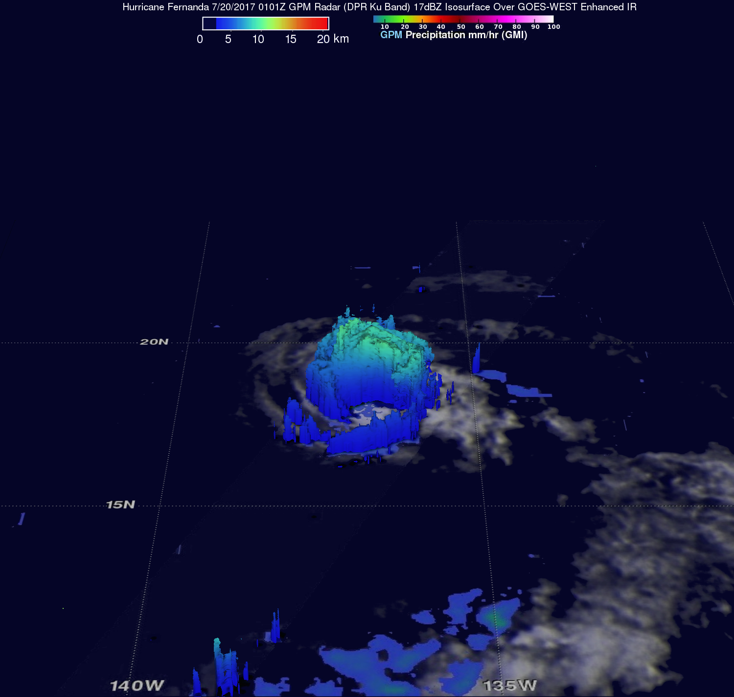
This 3-D view of Fernanda was produced using GPM's Radar (DPR Ku band). This examination of the hurricanes precipitation structure showed that the highest storm tops were located in the strong storms northwest of Fernanda's center. GPM's DPR showed that a few of these storms had tops that were reaching heights above 6.7 miles (10.8 km).