GPM Views Increasingly Powerful Tropical Cyclone Fantala
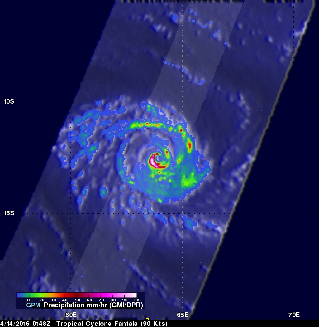
Tropical cyclone Fantala has continued to intensify while moving westward over the open waters of the South Indian Ocean. The GPM core observatory satellite passed directly over Fantala's eye on April 14, 2016 at 0148 UTC. At that time the tropical cyclone had maximum sustained winds estimated at 90 kts (104 mph) making in the equivalent of a category two tropical cyclone on the Saffir-Simpson hurricane wind scale. GPM's Microwave Imager (GMI) and Dual-Frequency Precipitation Radar (DPR) instruments again captured data that were used to estimate rainfall within Fantala. Rain was measured by GPM's DPR falling at a rate of almost 300 mm (11.8 inches) per hour on the southwestern side of the tropical cyclone's well defined eye. GPM also found some extremely intense showers in a feeder band wrapping around Fantala's northern side where echoes of over 58 dBZ were being returned to the satellite.
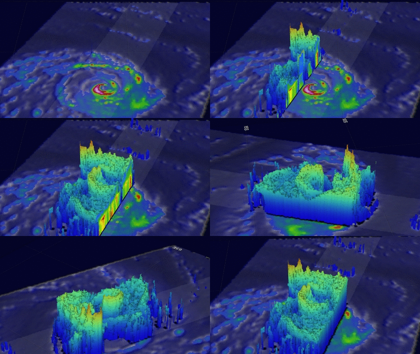
GPM's radar (DPR Ku Band) were used to show the 3-D structure of precipitation within tropical cyclone Fantala. This image shows a 3-D vertical slice through the center of the tropical cyclone's eye. DPR measured storm top heights above Fantala's eye reaching altitudes above 13 km (8 miles). Extremely tall thunderstorms reaching heights of over 17 km (10.5 miles) were found by GPM in the feeder band on Fantala's northern side.
Tropical cyclone Fantala is still increasing in power. The Joint Typhoon Warning Center (JTWC) expects winds to peak at 120 kts (138 mph) on April 15,2016. Fantala is predicted to be weaken slightly to 95 kts (109 mph) when it is northwest of Madagascar on April 17, 2016.


