
Heavy Downpours Cause Flooding In The Midwest
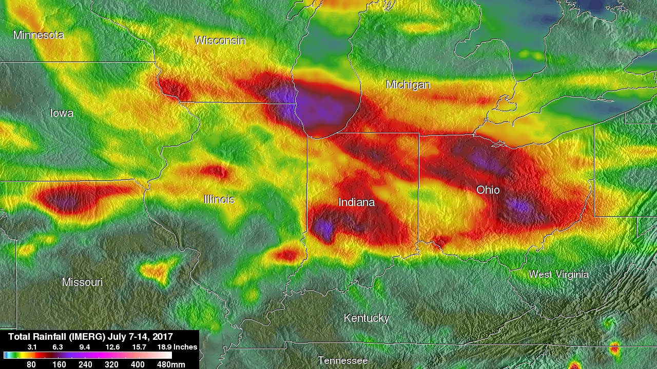
Heavy rain has resulted in significant flooding in the Midwest during the past week. Water flowing into the Fox River in northeastern Illinois caused serious flooding in that area. Central Indiana and central Ohio have also had remarkable flooding. NASA's Integrated Multi-satelliE Retrievals for GPM (IMERG) data were used to show estimates of rainfall accumulation in the Midwest during the period from July 7-14, 2017. This analysis indicates that parts of Wisconsin, Illinois, Indiana and Ohio had the highest rainfall totals during the period with over 6 inches (152.4 mm) of rain being seen in many areas.
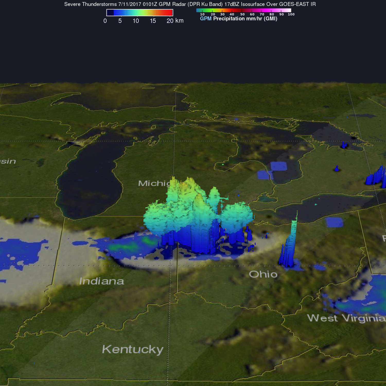
On Sunday, Monday, and Tuesday severe thunderstorms spawned tornadoes in the Midwest. The GPM core observatory satellite flew above when tornadoes were being sighted in northeastern Indiana and northwestern Ohio storms on Monday evening July 10 (July 11, 2017 at 0101 UTC). One of these tornadoes was spotted in Huntington county, Indiana at almost the same time that the satellite was scanning that area. GPM's radar swath is shown in lighter shades. This 3-D view of the rainfall structure in this storm was constructed from data collected when GPM's Dual-Frequency Precipitation Radar (DPR) instrument scanned the storm. Those GPM radar data showed that a few powerful thunderstorms had tops that were reaching altitudes above 9.1 miles (14.7 km). Rain was measured by GPM's Radar (DPR Ku Band) falling at a rate of over 2.5 inches (64 mm) per hour.