Heavy Rainfall Leads To Deadly California Mudslides
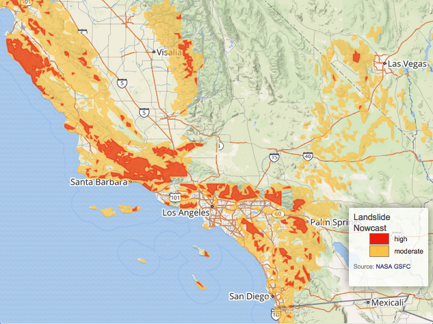
Winter rains falling on recently burned ground triggered deadly mudslides near Santa Barbara, California on the 9th of January. The potential for landslides is shown above. It was generated by the global Landslide Hazard Assessment for Situational Awareness (LHASA) model, a model that combines GPM precipitation data with a global landslide susceptibility map. LHASA gives a broad overview of landslide hazard in nearly real time, but site-specific information should be obtained prior to emergency operations or building projects.
At least 15 residents of southern California have been killed by the deadly mudslides. A storm moving in from the Pacific Ocean dropped heavy rain over soil that was laid bare by last month's wild fires. Heavy rainfall loosened surface sediments in Santa Barbara County early Tuesday caused deadly mudslides.
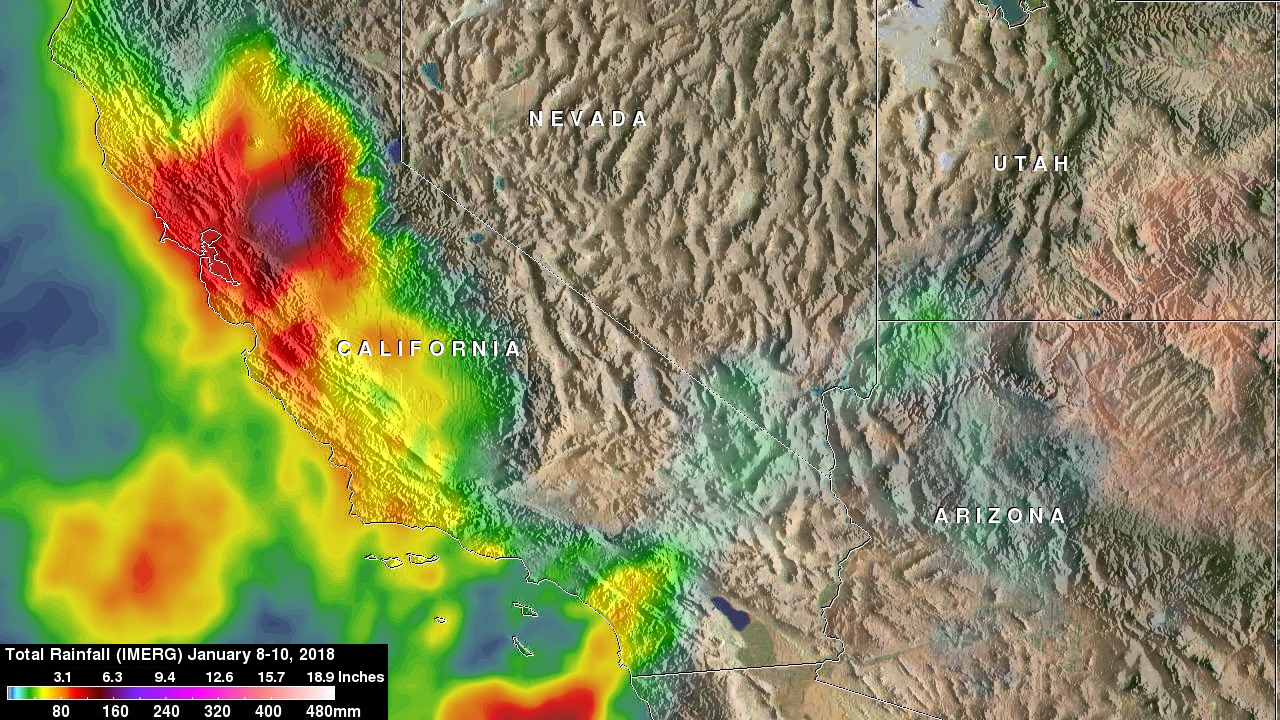
This rainfall analysis was constructed using NASA's Integrated Multi-satellitE Retrievals for GPM (IMERG) data. Precipitation data acquired from satellites in the GPM Constellation during the period from January 8-10, 2018 were used in this rainfall accumulation map. This analysis shows the heavy rainfall that occurred over California during the past three days. The heaviest rainfall in this analysis is shown over the Sacramento Valley where over 8 inches (203 mm) were indicated. Southern California had heavy rainfall but the effects of the drenching rain was magnified by the bare soil left by last months wild fires. A rainfall total of 5 inches (127 mm) was reported in Ventura County.